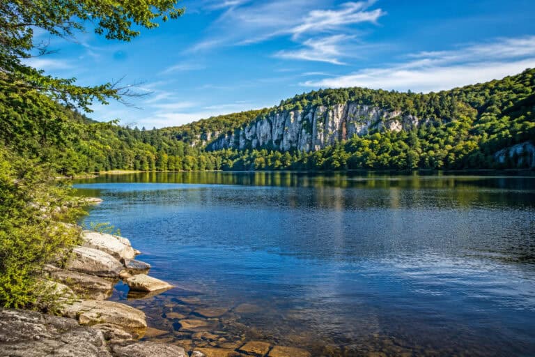
Santa Ynez is known for fabulous vineyards, but the town has more to offer to its guests. The valley is surrounded by mountains with stunning lakes, which provide plenty of trails.
The hikes here are moderate to strenuous because of the mountainous, exposed terrain, but the landscape is varied. There are wind caves, a canyon, a lake, and several mountain peaks to enjoy.
Trails near Santa Ynez:
- Gaviota Wind Caves Trail
- Trespass Trail to Gaviota Peak and Hot Springs
- Nojoqui Falls Trail
- Grass Mountain Trail
- Tequepis Peak Trail
- Aliso Canyon Trail
- Sweetwater Trail by Lake Cachuma
- Figueroa Mountain
- Lover’s Loop
- McKinley Mountain
1. Gaviota Wind Caves Trail

- Type: Out and Back
- Trail Length: 3 miles
- Elevation Gain: 648 ft
- Time to Complete: 1h 30min
- Difficulty: Moderate
- Parking: Trailhead Lot: Google Maps
- Distance from Santa Ynez: 20 miles (30 min)
- Dog Friendly: No
Description: Gaviota Wind Caves Trail is a popular route with sweeping ocean views, railway trestle, and unique wind caves.
You can extend this hike through the Gaviota State Park; there are more trails here to explore. The terrain is moderate but exposed, with a few steep sections near the caves.
2. Trespass Trail to Gaviota Peak and Hot Springs

- Type: Loop
- Trail Length: 7 miles
- Elevation Gain: 2,317 ft
- Time to Complete: 3h 30min
- Difficulty: Hard
- Parking: Trailhead Lot: Google Maps
- Distance from Santa Ynez: 16 miles (25 min)
- Dog Friendly: No
Description: Trespass Trail is a fun but challenging hike to the 2,458-foot peak, with hot springs at the end to soak those tired feet.
The terrain is steep in places with loose gravel. Most of the trail is sun-exposed, so it’s a scorcher on hot days. Still, the ocean views don’t disappoint, and the hills around are stunning.
3. Nojoqui Falls Trail

- Type: Out and Back
- Trail Length: 0.8 miles
- Elevation Gain: 241 ft
- Time to Complete: 30min
- Difficulty: Easy
- Parking: Trailhead Lot: Google Maps
- Distance from Santa Ynez: 11 miles (20 min)
- Dog Friendly: Yes
Description: Nojoqui Falls is a popular stop just off Highway 101. During the wet season, the falls are ‘no jokee’ as the water cascades from 100 feet. Yet, most of the year, it’s a slow dripping down the moss-covered wall; still very pretty. The trail to the falls is easy, well maintained, and runs in the shade – a perfect leg stretch.
4. Grass Mountain Trail

- Type: Out and Back
- Trail Length: 5.5 miles
- Elevation Gain: 2,515 ft
- Time to Complete: 3h
- Difficulty: Hard
- Parking: Trailhead Lot: Google Maps
- Distance from Santa Ynez: 12 miles (20 min)
- Dog Friendly: Yes
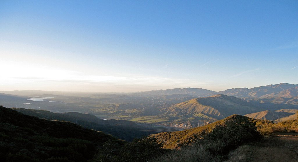
Description: Grass Mountain Trail is a highly-rated climb to the 3,685-foot peak. It starts off gentle but finishes with a brutal push to the summit. Californian poppy meadows and breathtaking views make this trail one of the best near Santa Ynez.
5. Tequepis Peak Trail

- Type: Out and Back
- Trail Length: 8 miles
- Elevation Gain: 2,589 ft
- Time to Complete: 4h
- Difficulty: Hard
- Parking: Trailhead Lot: Google Maps
- Distance from Santa Ynez: 10 miles (15 min)
- Dog Friendly: Yes
Description: Tequepis Trail is a challenging but top-rated hike near Lake Cachuma. The climb is steady, with loose rocks and practically no shade; only the breeze will cool you down.
However, the views are what this hike is all about. They’re absolutely stunning, with sweeping panoramas in every direction.
6. Aliso Canyon Trail

- Type: Lollipop
- Trail Length: 3.3 miles
- Elevation Gain: 821 ft
- Time to Complete: 2h
- Difficulty: Moderate
- Parking: Trailhead Lot: Google Maps
- Distance from Santa Ynez: 20 miles (30 min)
- Dog Friendly: Yes
Description: Aliso Canyon Trail is a fun lollipop loop with a mix of exposed canyon walls and hills. The terrain is rugged and sun-exposed, but the unusual landscape and rich wildlife make it worth the drive.
7. Sweetwater Trail by Lake Cachuma

- Type: Out and Back
- Trail Length: 4.5 miles
- Elevation Gain: 583 ft
- Time to Complete: 2h
- Difficulty: Moderate
- Parking: Recreation Area Lot: Google Maps
- Distance from Santa Ynez: 8 miles (10 min)
- Dog Friendly: Yes
Description: Sweetwater Trail is a shoreside route along the charming Lake Cachuma. It connects the recreation area with the dam overlook. The terrain is relatively flat but has a few steep sections.
There is also access to the lake along the way, perfect for picnics. Also, the lake’s recreation area is very well developed and excellent for camping, glamping, and boating.
8. Figueroa Mountain

- Type: Out and Back
- Trail Length: 4 miles
- Elevation Gain: 914 ft
- Time to Complete: 2h
- Difficulty: Moderate
- Parking: On the Road: Google Maps
- Distance from Santa Ynez: 17 miles (35 min)
- Dog Friendly: Yes
Description: Figueroa Mountain is a moderate climb to the popular lookout area. The route is entirely on the fire road, which is shaded apart from the final section. It is a very gentle climb suitable for beginners and families with small kids.
The views at the top are terrific and give you the ‘top of the world’ feeling. And the trail extends further so you can add to your adventure.
9. Lover’s Loop

- Type: Loop
- Trail Length: 4.7 miles
- Elevation Gain: 718 ft
- Time to Complete: 2h
- Difficulty: Moderate
- Parking: Trailhead Lot: Google Maps
- Distance from Santa Ynez: 12 miles (20 min)
- Dog Friendly: Yes
Description: Lover’s Loop is a fun trail that runs at the base of Grass Mountain. It’s a very popular scenic route with typical for the area landscape.
The trail is relatively flat and has a few shaded sections to cool off, making it the perfect alternative to the Grass Mountain climb.
10. McKinley Mountain

- Type: Out and Back
- Trail Length: 22.4 miles
- Elevation Gain: 4,493 ft
- Time to Complete: 2-4 days
- Difficulty: Hard
- Parking: Trailhead Lot: Google Maps
- Distance from Santa Ynez: 17 miles (35 min)
- Dog Friendly: Yes
Description: McKinley Mountain is a highly rated backpacking trail in San Rafael Wilderness. The route follows the old fire road all the way to the McKinley Campsite near the summit. Most spend the night there before the final push to the peak.
The climb is grueling, especially at the start, and some sections are overgrown. There is no signal for most of the route, and the trail markings are sparse, so make sure you have alternative means of navigation.
Overall, it’s a multiday backpacking adventure for experienced hikers who thrive on challenges.
Final Thoughts
Santa Ynez Valley is surrounded by fantastic hikes with various highlights and features. You can easily combine a wine tour with a nature trip.
And this list has the area’s top-rated routes on one page, so it is easier for you to decide on your next adventure.
More Trails in California:
- Lake Chabot
- Fremont
- San Francisco
- Alameda
- Vista
- Pismo Beach
- Big Sur Coast
- Santa Rosa
- Bakersfield
- Escondido
- Fresno
- Moreno Valley
Lakes in California:
Beaches in California: