Big Sur Coast is one of the top destinations in the country, which attracts millions of visitors every year. It is also primitive, with only a few developed areas along Highway 1.
This list will help you make the best of your time in Big Sur. It consists of top-rated hikes of different lengths with various levels of difficulty.
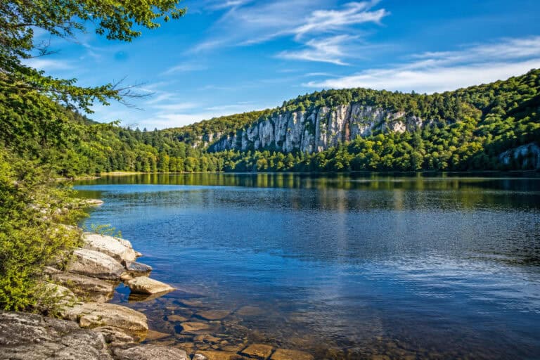
Trails on Big Sur Coast:
- Panorama and Ridge Trails Loop
- Partington Cove Trail
- McWay Falls Overlook
- Buzzards Roost Trail
- Pfeiffer Falls Trail
- Pine Ridge Trail to Sykes Hot Springs
- Tanbark Trail to Tin House Overlook
- Timber Top/ Boranda Trail
- Big Sur River Gorge Trail
- Vicente Flat Trail to Vicente Camp
- Cruickshank Trail to Upper Cruickshank Camp
- Soda Springs Creek to Buckeye Campground
- Salmon Creek Trail to Estrella Camp
- East Molera Trail to Post Summit
- Pico Blanco via Little Sur Trail
1. Panorama and Ridge Trails Loop

- Highlight: Highest-rated trail on the Big Sur Coast; has both beach and ridge sections; killer views of the coastline.
- Type: Lollipop
- Trail Length: 8 miles
- Elevation Gain: 1,440 ft
- Time to Complete: 4h
- Difficulty: Moderate
- Parking: Andrew Molera Park Lot: Google Maps
- Dog Friendly: No
Panorama and Ridge trails make an 8-mile lollipop loop, the highest-rated route on the Big Sur Coast. It’s primarily used for hiking and birdwatching.
This trail is rated moderate because of the 1,440ft of elevation gain and little shade, which makes it more challenging.
The route starts with Creamery Meadow Trail and takes you across the Big Sur River, which can be knee-deep sometimes.
It then runs parallel to the coastline providing access to Molera Beach and producing remarkable views all along.
The biggest complaint about this trail is the lack of shade. So, bring plenty of sun cream and water to be safe.
Despite the absence of shade, this lollipop loop is highly popular with Big Sur visitors probably because it combines many experiences in one. The views, the beach, a few redwood groves, and the fantastic moderate hike.
2. Partington Cove Trail

- Highlight: Short, steep, shaded trail to the protected cove; perfect quick pitstop if taking Hwy 1.
- Type: Out and Back
- Trail Length: 1.1 miles
- Elevation Gain: 347 ft
- Time to Complete: 30min
- Difficulty: Moderate
- Parking: On the Verge near the Trailhead: Google Maps
- Dog Friendly: No
Partington Cove Trail is a 1.1 mile out and back path near Big Sur town. It’s the perfect scenic break from driving.
Although relatively short, it has an elevation gain of 347ft because of the steep road that leads to the protected cove and lookouts.
The trail is often busy, but it features charming woods, rocky coves with crashing waves, and a fun tunnel.
The biggest complaint is finding the road to Partington Cove to start with. It is located right on the bend, opposite a small layby, and accessed via an old gate.
The trail is well-developed and easy to follow but doesn’t have any restrooms. Still, the stunning beauty of the area and ocean vistas are worth a quick stop.
3. McWay Falls Overlook

- Highlight: Very short and popular walk to must-see McWay Falls Overlook; sweeping ocean views and a charming cove.
- Type: Out and Back
- Trail Length: 1.2 miles
- Elevation Gain: 193 ft
- Time to Complete: 30min
- Difficulty: Easy
- Parking: McWay Waterfall Parking: Google Maps
- Dog Friendly: No
McWay Falls Overlook Trail is a 1.2-mile route that leads to one of the most popular destinations on the Big Sur coast – McWay Falls.
The trail is excellent for all skill levels, with just 193ft of elevation gain, and has a stroller and wheelchair-friendly section.
It runs on cliffs along the coast and reaches a viewpoint where you can see gorgeous McWay Falls that pours right onto the beach created by a 1983 landslide.
Although the views of McWay Falls and the coastline are stunning, this is a very short hike best used as a stop-off point before moving on to others.
That being said, it’s very well developed, and the trailhead has plenty of parking and a restroom. A must-do pitstop!
4. Buzzards Roost Trail

- Highlight: Short hike to the hilltop with some ocean views; runs through the shaded forest with some redwoods; good summer option.
- Type: Lollipop
- Trail Length: 2.6 miles
- Elevation Gain: 810 ft
- Time to Complete: 1h 30min
- Difficulty: Moderate
- Parking: Small Lot on the Verge: Google Maps
- Dog Friendly: No
Buzzards Roost Trail is a 2.6-mile route near Big Sur. It’s mainly used for hiking and nature trips.
It is a moderate hike with 810ft of elevation, which is steady without any particularly steep sections.
The trail offers a fantastic shaded walk near the Big Sur River. If you’re camping in one of the many campsites nearby, then this is a great vantage point to get to know the area.
The biggest complaint here is the steep switchbacks. Although challenging, they run through the shaded forest, making the hike a good option for hot summer months.
Still, the route is well-maintained and easy to follow. If nothing else, it’s a great place to get used to the area before checking out other trails nearby.
5. Pfeiffer Falls Trail

- Highlight: Short but charming trail to the waterfall; well-maintained and easy to follow; lots of shade.
- Type: Lollipop
- Trail Length: 1.3 miles
- Elevation Gain: 403 ft
- Time to Complete: 45min
- Difficulty: Easy
- Parking: At the Trailhead Lot: Google Maps
- Dog Friendly: No
Pfeiffer Falls Trail is a 1.3-mile lollipop loop near Big Sur, California. It’s used year-round for hiking trips.
The trail is excellent for all skill levels, with just 403ft of elevation. It’s kid-friendly, but bring sensible shoes for its rocky terrain.
The route takes you over the Pfeiffer-Redwood Creek and then to a viewpoint where you can see the charming Pfeiffer Falls (if there is enough water).
The trail is well-kept and has many sections with stairs instead of steep inclines, making life easier but taking away the wilderness feel.
Despite this, Pfeiffer Falls Trail is worth the visit, especially in summer, as it primarily runs through shaded groves and along the creek.
Also, there are campgrounds, a lodge, and many other routes in the area; it’s a small developed corner on the otherwise primitive Big Sur coast.
6. Pine Ridge Trail to Sykes Hot Springs

- Highlight: Fantastic backpacking trail with lots of wild and plant life; runs through woodlands with many creek crossings and camping options along the way.
- Type: Out and Back
- Trail Length: 18.9 miles
- Elevation Gain: 5,242 ft
- Time to Complete: 1-2 days
- Difficulty: Hard
- Parking: At the Trailhead Lot: Google Maps
- Dog Friendly: Yes
Pine Ridge Trail to Sykes Hot Springs is an 18.9 mile out and back hike near Big Sur. It’s popular with campers, backpackers, and hikers.
The trail climbs a huge 5,242ft over 18.9 miles. As such, it’s rated as difficult and should only be attempted by experienced hikers.
The route has everything from creek crossings, views of the valley, waterfalls, and, of course, the amazing Sykes Hot Springs.
Although very rewarding because of all you’ll see, this is a challenging hike. The rocky terrain can be hard to navigate, and steep inclines can be tricky.
There are a few primitive campsites along the route (Terrace Creek and Barlow Flat), making it a fantastic backpacking destination.
Experienced hikers will enjoy a soak in the Sykes Hot Springs after a grueling hike. The path is well maintained and clearly signposted, too.
7. Tanbark Trail to Tin House Overlook

- Highlight: Steep trail to the Tin House Overlook; runs through redwood and oak groves and along the creek; ocean views from the top.
- Type: Out and Back
- Trail Length: 7 miles
- Elevation Gain: 2,024 ft
- Time to Complete: 4h
- Difficulty: Hard
- Parking: On the Verge near the Trailhead: Google Maps
- Dog Friendly: No
Tanbark Trail is a loop trail to Tin House Overlook. However, because a mile of it runs on Hwy 1, it is recommended to hike this trail as an out and back route. This way, you will skip a few lookouts but avoid walking on the Highway.
The trail is a difficult one, with 2,024ft of elevation gain. It’s best to bring plenty of water and make sure you’re confident with the route.
The path runs through the hills above the Big Sur, with panoramic views of the stunning coastline. At the Tin House Overlook, the vistas get even better, and the breathtaking landscape will leave you speechless.
While undoubtedly beautiful, the biggest complaint is the loose gravel track which can be difficult and slippery when going down.
Still, the route offers some of the best views of the coast, and the trail itself is easy to follow and well-maintained.
8. Timber Top/ Boranda Trail

- Highlight: Short but incredibly steep trail to the campground and the lookout; killer views all the way; not recommended in summer.
- Type: Out and Back
- Trail Length: 5.3 miles
- Elevation Gain: 2,503 ft
- Time to Complete: 3h
- Difficulty: Hard
- Parking: On the Verge near the Trailhead: Google Maps
- Dog Friendly: Yes
Timber Top/Boranda Trail is a 5.3 mile out and back hike near Big Sur. It’s primarily used by experienced hikers.
It’s a very strenuous trail with 2,503ft of elevation gain with scrambling sections throughout the hike.
The Boranda Trail will take you past Boranda Ridge, by Lafler Creek, and through the Los Padres national forest until you reach Timber Top Camp.
The biggest complaint is the lack of shade, which makes an already difficult trail even harder.
Bring sunscreen, bug spray, and sturdy footwear to beat this trail. Those who complete the ascent may wish to spend the night at the beautiful Timber Top Camp.
9. Big Sur River Gorge Trail

- Highlight: Short and flat trail along the river; prepare to get your feet wet; perfect for cooling down in the summer.
- Type: Out and Back
- Trail Length: 1.2 miles
- Elevation Gain: 75 ft
- Time to Complete: 30min
- Difficulty: Easy
- Parking: Near South Campsite: Google Maps
- Dog Friendly: No
Big Sur River Gorge Trail is a 1.2 mile out and back route near Big Sur that follows the river canyon.
This trail is perfect for all skill levels, with just 75ft of elevation. It’s especially great for kids who will enjoy splashing in the water.
This trail takes you along the Big Sur River, with crossing points in several locations. It’s a fun-filled family adventure.
However, the path is not well maintained at all, with overgrown areas forcing you into the river more and more.
With the proper clothing (non-slip shoes, and waders, perhaps) this trail can be one of the best adventures and the perfect choice for hot summertime.
10. Vicente Flat Trail to Vicente Camp

- Highlight: Highly-rated trail in Ventana Wilderness with killer ocean views and steep, narrow sections; perfect for backpacking.
- Type: Out and Back
- Trail Length: 10.9 miles
- Elevation Gain: 2,595 ft
- Time to Complete: 6h
- Difficulty: Hard
- Parking: Kirk Creek Campground: Google Maps
- Dog Friendly: Yes
Vincente Flat Trail to Vincente Camp is a 10.9 mile out and back trail near Lucia. It’s used for hiking, camping, and backpacking.
The trail climbs 2,595ft and is rated as difficult because of the steep incline, the rocky terrain, and little shade.
The route starts at Kirk Creek Campground, passes Espinosa camp around 2 miles in, and then reaches Vincente Camp towards the end of the hike. Many people camp here, breaking this strenuous route into two days.
Although a lot of fun, with lovely wildflowers and scenery, be prepared for the rugged rocky terrain and lots of bugs and poison oak.
With many campsites to stop over, the route is well-developed and easy to follow. But the trail from Espinosa to Vincente is not as well-maintained as it could be.
11. Cruickshank Trail to Upper Cruickshank Camp

- Highlight: Spectacular hike with killer ocean views and a cool creek at the end to soak tired feet; steep switchbacks at the start.
- Type: Out and Back
- Trail Length: 5.2 miles
- Elevation Gain: 1,368 ft
- Time to Complete: 3h
- Difficulty: Moderate
- Parking: On the Verge near the Trailhead: Google Maps
- Dog Friendly: Yes
Cruickshank Trail to Upper Cruickshank Camp is a 5.2 mile out and back trail near San Simeon. It’s primarily used for camping, hiking, and nature trips.
The trail is moderate, with 1,368ft of elevation gain. Some reported that it’s kid-friendly which could make it a fun camping trip.
The route has several fun switchbacks, redwood groves, creek crossings, and a couple of primitive campsites for backpacking adventures.
The biggest problem here is that it isn’t well-maintained, with overgrown sections making it difficult to navigate in parts.
Still, the challenge is worth it because the trail system by Upper Cruickshank Camp is so impressive that it’s difficult not to fall in love with the entire area and make you want to explore more!
12. Soda Springs Creek to Buckeye Campground

- Highlight: Similar hike to the above – steep at the start but with stunning ocean views; campsites in the area.
- Type: Out and Back
- Trail Length: 5.8 miles
- Elevation Gain: 1,676 ft
- Time to Complete: 3h
- Difficulty: Moderate
- Parking: Small Layby at the Trailhead: Google Maps
- Dog Friendly: Yes
Soda Springs Creek to Buckeye Campground is a 5.8 mile out and back trail near Big Sur. It’s used for hiking, running, and camping.
The trail has a 1,676ft elevation gain and is rated as moderate. The lack of shade on the route also adds to the challenge.
The trail crosses over Soda Springs Creek as you hike through the Silver Peak Wilderness. Buckeye Campground has tables and neat sites where you can camp or stop for lunch.
Although a fun hike, it has poison oak and coming back is difficult because of a few steep descents.
Despite this, it’s a family and dog-friendly destination with well-maintained paths.
13. Salmon Creek Trail to Estrella Camp

- Highlight: Beautiful hike with shaded areas but steep in places; perfect for backpacking; don’t miss beautiful Salmon Creek Waterfall.
- Type: Out and Back
- Trail Length: 7.2 miles
- Elevation Gain: 2,106 ft
- Time to Complete: 4h
- Difficulty: Moderate
- Parking: Small Layby at the Trailhead: Google Maps
- Dog Friendly: Yes
Salmon Creek Trail to Estrella Camp is a 7.2 mile out and back trail near San Simeon. It’s primarily used for camping and hiking.
This trail is rated as moderate with 2,106ft of elevation. The path can be tricky in places, and the inclines are steep and strenuous.
The route is beautiful, though, offering a shaded walk along Salmon Creek with a few charming waterfalls on the way and glimpses of the ocean.
Also, the trail extends to Lion Peak and Three Peaks and has multiple primitive campgrounds making it a popular backpacking destination.
Although there are plenty of camping and resting opportunities on this hike, there have been reports of bear activity in the area, so be cautious.
14. East Molera Trail to Post Summit

- Highlight: Tough trail to the peak; sun-exposed with some very steep sections; stunning views of the ocean and Pico Blanco mountain.
- Type: Out and Back
- Trail Length: 9.1 miles
- Elevation Gain: 3,805 ft
- Time to Complete: 5h
- Difficulty: Hard
- Parking: Small Layby at the Trailhead: Google Maps
- Dog Friendly: No
East Molera Trail to Post Summit is a 9.1 mile out and back trail near Big Sur. It’s popular with hikers and backpackers.
The trail is rated as difficult, with 3,805ft of elevation gain and steep, challenging descents on the way back.
The route is peaceful, with many wildflowers, wildlife, and stunning ocean views.
The only critique of this trail is that it has ticks. Unfortunately, there are plenty of them in the area, but trousers and bug spray should easily fix that.
The stunning Post Summit stands at 3,445ft and offers some of the most rewarding views in the area, which is the hike’s main attraction. Yes, it’s a challenge, but one that’s worth it!
15. Pico Blanco via Little Sur Trail

- Highlight: Killer hike to the 3,694-foot peak; beautiful creek, redwood groves, and stunning view; very few people;
- Type: Out and Back
- Trail Length: 14 miles
- Elevation Gain: 4,016 ft
- Time to Complete: 7h
- Difficulty: Hard
- Parking: Coast Rd near the Trailhead: Google Maps
- Dog Friendly: No
Pico Blanco via Little Sur Trail is a 14 mile out and back trail near Big Sur. It’s primarily used for hiking, backpacking, and wildlife watching.
This trail is rated as difficult. While the 4,016ft elevation gain is hard, the distance makes it even harder.
Still, this trail is fantastic. Some people hike Coast Road before joining the Little Sur Trail, but you can actually drive to the trailhead and park on the verge of Coast Road, saving yourself exposed, dusty walk.
Little Sur Trail crosses the Little Sur River multiple times, zigzagging to the most prominent peak in the area – Pico Blanco (3,694ft).
The trail is not for the faint-hearted, and the switchbacks to the peak are brutal. Bring proper footwear and hiking polls to make your life easier.
However, the views from the summit of Pico Blanco are second to none, and the trail itself is easy to follow, even if it’s hard to complete!
Final Thoughts
From demanding backpacking expeditions to 30-minute strolls, the Big Sur coast has it all. The above list is by no means complete; there are many more hikes in the area. However, it consists of the highest-rated trails that most hikers loved; and chances are, you would love them too.
Alternatively, if you are tired of the crowds and looking for a tranquil wilderness experience, try Henry W. Coe State Park.
More Trails in California:
- Lake Chabot
- Fremont
- San Francisco
- Alameda
- Santa Ynez
- Vista
- Pismo Beach
- Santa Rosa
- Bakersfield
- Escondido
- Fresno
- Moreno Valley
Lakes in California:
Beaches in California: