Washington State offers a diverse range of landscapes, from savannah shrublands in the east to classic PNW forests in the west. And thanks to the state’s commercial past, many of these landscapes can be explored by rail-trails.
This list is a collection of the highest-rated rail-trails in the state. It will help you choose a suitable adventure, be it an urban workout or a wilderness expedition.
Best Rail-Trails in Washington:
- Bill Chipman Palouse Trail
- Burke-Gilman Trail
- Cascade Trail
- Chehalis Western Trail
- Fish Lake Trail
- Foothills Trail
- Iron Goat Trail
- Olympic Discovery Trail (ODT)
- Palouse to Cascades State Park Trail
- Sammamish River Trail
- Snohomish County Centennial Trail
- Snoqualmie Valley Trail
- Yelm-Tenino Trail
- Spokane River Centennial State Park Trail
- Yakima Greenway
- Columbia Plateau Trail
Quick Pick:
- Burke-Gilman Trail (#2) – the best urban trail.
- Columbia Plateau Trail (#16) – remote and wild, perfect bikepacking adventure.
- Palouse to Cascade State Park Trail (#9) – the 2nd longest in America.
- Iron Goat Trail (#7) – a classic hiking trail with steep sections and lots of history.
- Snohomish County Centennial Trail (#11) – best for railroad history.
1. Bill Chipman Palouse Trail

- Highlights: Busy but well-kept trail between Moscow and Pullman.
- Length: 7.1 miles
- Surface: Asphalt
- Activities: Biking, Walking, Inline Skating, Cross Country Skiing, Wheelchair Accessible
- Start: Bishop Blvd, Pullman: Google Maps
- Finish: Premier Drive, Moscow: Google Maps
Bill Chapman Palouse Trail offers 7.1 miles of tarmacked bliss. It connects Washington State University and the University of Idaho, providing a car-free commuter option.
It is an easy route with a slight incline suitable for hiking, running, and pretty much any activity on wheels. Stroller-approved and wheelchair accessible, it really is a place for everyone.
However, there are two complaints about the route. First, the trail runs along Route 270, which makes it rather noisy. Second, it gets pretty busy with other users as it is the best paved route in the area.
Despite these negative factors, it is a highly-rated destination for many recreational activities. Folks use it for marathon training, cycling, and walking.
Also, you can use the trail to travel to WSU Bear Center to see grizzly bears playing in the “exercise yard.” Or, access WSU Arboretum which is a fantastic hiking destination of its own.
2. Burke-Gilman Trail

- Highlights: One of the first rail-trails in America. A little busy but flat and easy.
- Length: 18.8 miles
- Surface: Asphalt
- Activities: Biking, Walking, Inline Skating, Wheelchair Accessible
- Start: 102nd Ave NE, Bothell: Google Maps
- Finish: Golden Gardens Park, Seattle: Google Maps
Steeped in history, the Burke-Gilman trail is one of the first rail-trails in the country. Running for 18.8 miles, it is a major car-free commuting route in Seattle. And a stretched playground for runners, hikers, and cyclists.
Like most of the former railway routes, Burke-Gilman is flat and easy, practically without any incline. It is also 100% tarmacked and smooth – great for rollerbladers and skaters.
Because of its urban nature, the most common criticism about the trail is how busy it gets; perhaps this is a testament to its popularity.
One of the best sections of the route is the Washington Lake stretch. The views are fantastic, and you can see nice houses along the way.
Also, the sections that run through the city provide access to multiple landmarks, parks, and places pitstop for lunch. And the fact that the path is separated from traffic means that you can disconnect and just ride your bike.
3. Cascade Trail

- Highlights: Peaceful gravel trail with lovely scenery, great for trail running.
- Length: 22.5 miles
- Surface: Gravel
- Activities: Biking, Walking, Horseback Riding, Cross Country Skiing
- Start: Polte Road, Sedro-Woolley: Google Maps
- Finish: S Dillard Ave, Concrete: Google Maps
Cascade Trail can be found in Skagit County, Washington. It stretches for 22.5 miles from Sedro-Woolley to Concrete.
Being a flat gravel trail, it is excellent for horseback riding, skiing, hiking, or mountain biking. The route’s only challenge is its length, but there are many access points along the way for chunking it into sections.
The only minor complaint about the trail is that it runs parallel to Hwy 20. Although you can’t even see the road, you can hear the traffic that reminds you of the civilization nearby.
But don’t let this stop you; Cascade Trail has lots to offer. It comes close to the Skagit River, which provides for some beautiful views. And has 23 trestles and two bridges made from railroad cars that make for an exciting journey.
Furthermore, there are 12 benches on the route and multiple towns with small eateries – perfect for stopping for lunch when you get tired.
4. Chehalis Western Trail

- Highlights: Easy and pretty trail, shaded almost all the way; family-friendly and not too busy.
- Length: 21.2 miles
- Surface: Asphalt
- Activities: Biking, Walking, Horseback Riding, Inline Skating, Wheelchair Accessible
- Start: Woodard Bay Conservation Area: Google Maps
- Finish: Yelm-Tenino Trail, Rainier: Google Maps
Chehalis Western Trail is 21.2 miles long. It begins at the Woodard Bay Conservation Area and runs through the residential community of Lacey to the Deschutes river valley, and terminates near Rainier.
Former Weyerhaeuser Timber Co. railroad, it is now a tarmacked route with a flat and smooth surface. You can rollerblade from the bay all the way to Rainier if your heart desires.
Despite the trail passing through Olympia’s suburbs, it doesn’t get busy; there is plenty of space for everyone.
Also, Chehalis Western is mostly shaded and passes through multiple lakes and parks, making it a great choice in summer.
Another cool thing about the trail is that it ends at Yelm-Tenino Trail (#13 on this list), splitting it in the middle. This means that you can easily extend the route creating an excellent bikepacking expedition.
Related: Best Hiking and Running Trails near Olympia
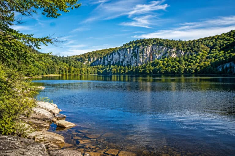
5. Fish Lake Trail

- Highlights: Quiet trail that runs along the railway, flat and easy; perfect for biking.
- Length: 9 miles
- Surface: Asphalt
- Activities: Biking, Walking, Horseback Riding, Inline Skating, Wheelchair Accessible
- Start: S Lindeke St, Spokane: Google Maps
- Finish: Near Queen Lucas Lake, no access: Google Maps
Fish Lake Trail is a 9 miles long route in eastern Washington. It starts in Spokane and terminates 1.5 miles short of Fish Lake.
All nine miles of the trail are paved with asphalt, making it a smooth and accessible destination for skaters, rollerbladers, and bikers. And in winter, it can be used for cross country skiing.
The chief complaint about the route is that despite its name, it doesn’t provide access to Fish Lake; it terminates abruptly just before it.
However, there are plans to extend the trail to the lake by building several bridges across the railroad. So, eventually, it will connect to the town of Cheney and to the 130-miles Columbia Plateau rail-trail. (#16 on the list)
Despite that, it is a stunning route that becomes quieter the farther away from Spokane you travel. It runs through the pine groves and along the active railway tracks, which gives it a unique atmosphere.
6. Foothills Trail

- Highlights: Fantastic trail with Mt Rainier views, farms, and picnic areas, but segmented in places.
- Length: 31.3 miles
- Surface: Asphalt/ Gravel
- Activities: Biking, Walking, Horseback Riding, Inline Skating, Wheelchair Accessible
- Start: E Pioneer, Puyallup: Google Maps
- Finish: SE 416th St, Enumclaw: Google Maps
Foothills Trail is a highly-rated 31.3 miles route that starts in Puyallup and ends in Enumclaw. Also, it has a segmented side trail that runs from South Praire to Carbonado.
Puyallup to South Praire is the most popular section of the route. It is paved all the way, easy, smooth, and flat – perfect for anything on the wheels, including the wheelchairs.
Naturally, the biggest criticism about the Foothills Trails is that it’s segmented in places, but this doesn’t affect Puyallup to South Praire part. In fact, you can get all the way to Buckley without getting off the bike.
Yet, it is easy to understand why the trail gets high ratings; there are many highlights here.
For example, you can see Mt Rainier most of the way. If you visit in the fall, you can observe salmon spawning in South Prairie Creek. And in spring and summer, the Carbon River turns milky as the Mt Rainier glacier melts. In addition, there is plenty of wildlife to spot along the way.
Considering the trail’s proximity to Seattle’s greater area, it’s seemingly one of Washington’s most incredible and easily accessible destinations.
7. Iron Goat Trail

- Highlights: Hiking-only trail with rich history, yet remote and wild; has some steep sections and a 2,000-foot “snowshed.”
- Length: 9.2 miles
- Surface: Gravel/ Dirt
- Activities: Hiking, Walking, Wheelchair Accessible
- Start: Scenic: Google Maps
- Finish: Wellington: Google Maps
Iron Goat Trail is a 9.2 miles route with lots of railway history. The main access point is in Scenic, from where you can either take a 3-mile one-way track to Wellington or a more popular 6 miles loop west.
The trail is a hiking-only destination with singletrack that runs through the thick forest. It has some very steep sections with switchbacks, and the terrain is rocky and muddy – a superb hiking adventure.
The only minor complaint about the trail is that it’s overgrown in places which is the case with many wilderness trails in summer.
But don’t let this minor disadvantage stop you. The Iron Goat is a unique rail-trail destination and shouldn’t be missed.
The 6-mile loop section has eight old railway tunnels that you can peer into, yet they are unsafe for the public. And the Wellington section has a 2,000 feet snowshed built to protect the railway against avalanches.
But what makes this rail-trail special is its hiking appeal. Most rail-trails are flat and straight, perfect for cycling. The Iron Goat, however, is a walk in the woods with hills, rocks, and mud – it’s screaming to be hiked.
Need some hiking motivation? Check out this: Funny and Inspirational Hiking Quotes
8. Olympic Discovery Trail (ODT)

- Highlights: Highly-rated but segmented trail across Olympic Peninsula; offers different sections, from urban walks to remote wilderness.
- Length: 90 miles
- Surface: Asphalt/ Gravel
- Activities: Biking, Hiking, Walking, Horseback Riding, Wheelchair Accessible
- Start: Washington Street, Port Townsend: Google Maps
- Finish: Mary Clark Road, Sappho: Google Maps
Once completed, Olympic Discovery Trail (ODT) will traverse the whole length of the Olympic Peninsula starting from Port Townsend and ending in La Push and will be 130.8 miles long. And the good news is that 90 miles of this fantastic route are already completed.
Olympic Discovery Trail can be divided into five sections:
1) Larry Scott Trail. A popular 15-mile gravel track that connects Port Townsend with Four Corners, it has lots of shade and stunning views of the bay.
2) Four Corners to Blyn. This section is not completed yet, so you will have to find a way to Blyn.
3) Blyn to Elwha River is a mostly paved 35-mile section that passes through the towns of Sequim and Port Angeles, running along the base of the Olympic Mountains.
This urban section is excellent for cycling, skating, and rollerblading. Its most scenic part is between Morse Creek Trestle to Ediz Hook.
4) Elwha River to Sappho segment is only partly completed, but the section that runs along the Lake Crescent – known as Spruce Railroad Trail – is breathtaking. It is a paved path that passes through tunnels and has stunning views of the lake.
The rest of the section is mostly gravel with on and off-road tracks.
5) Sappho to La Push segment isn’t built yet; you will have to use the highway to complete all 130 miles.
Overall, Olympic Discovery Trail offers diverse scenery and trail conditions. Once completed, it will become one of the best destinations in PNW.
9. Palouse to Cascades State Park Trail

- Highlights: Trestle bridges, fantastic scenery, and a 2.5 miles long Iron Horse tunnel; bring flashlights and a jacket.
- Length: 223.8 miles
- Surface: Gravel
- Activities: Biking, Hiking, Walking, Horseback Riding
- Start: Cedar Falls: Google Maps
- Finish: Tekoa Idaho Road, Willard: Google Maps
At 223.8 miles, Palouse to Cascade State Park Trail is the 2nd longest rail-trail in America. It stretches from the Idaho border near Willard almost to Seattle, terminating at Cedar Falls.
What’s more, the trail is part of the developing 4,000 miles Great American Rail-Trail that will eventually connect Washington DC with Washington State.
The western part of the route (from Cedar Falls to Columbia River) is the most popular section. It crosses the Cascade Mountains that provide amazing scenery with high peaks and dense evergreen forests.
You will also cross multiple bridges and trestles, but the best highlight is a 2.5-mile unlit Snoqualmie tunnel. The 100 years old engineering wonder is cold, wet, and scary; flashlights and coats are advisable.
The eastern part of the route – from the Columbia River to the Idaho border – is fragmented. Once completed, the total length of Palouse to Cascade State Park Trail will be 285 miles.
This section of the trail traverses the beautiful Palouse Region with its irrigated farmland and desert-like scrublands. The settlements here are sparse, so make sure to plan your trip well.
10. Sammamish River Trail

- Highlights: Beautiful but busy riverside walk with plenty of wildlife; wide and paved all the way.
- Length: 11 miles
- Surface: Asphalt
- Activities: Biking, Walking, Horseback Riding, Inline Skating, Wheelchair Accessible
- Start: 102nd Ave, Bothell: Google Maps
- Finish: Marymoor Park, Redmond: Google Maps
Sammamish River Trail is an 11-mile route that connects Bothell and Redmond. It is an essential urban location for recreation and sports.
Running along the river, the trail is flat, smooth, and very easy. It is perfect for running, skating, rollerblading, and cycling.
The biggest issue with the trail is that it can get super busy, especially during the weekends.
Despite that, it is a superb route that runs via parks, farms, and some woodlands. You can spot turtles, otters, deer, and many birds, including bald eagles, ospreys, and kestrels.
Another great thing about this highly-rated trail is that it connects to Burke-Gilman Trail, which provides 19 miles of tarmacked joy.
11. Snohomish County Centennial Trail

- Highlights: Tranquil, forested trail with pretty towns and farms along the way. Not as busy as some other trails.
- Length: 30.5 miles
- Surface: Asphalt
- Activities: Biking, Walking, Horseback Riding, Inline Skating, Wheelchair Accessible
- Start: 1st Street, Snohomish: Google Maps
- Finish: Nakashima Barn off Route 9: Google Maps
Centennial Trail is 30.5 miles of absolute pleasure. It starts at Snohomish and finishes at Nakashima Barn past Pilchuck.
Like many other rail-trails, Snohomish Centennial Trail is paved and flat. Great for anyone using wheels but also for runners and walkers.
The only minor complaint about the trail is that it can be bumpy in places, but usually, such sections are replaced quickly.
Apart from that, there are no negatives. Centennial Trail scores really high for its stunning countryside views. You can see powdered peaks in the east and enjoy countless farms and pastures on the way.
Also, the trail is rich in railway history, and every charming town along the route celebrates its heritage. There are many antique stores, and the whole route is dotted with historical landmarks.
12. Snoqualmie Valley Trail

- Highlights: Fantastic trail with small historic towns, farmlands, mountain views, and trestle crossings; don’t miss 270-foot Snoqualmie Falls.
- Length: 31.7 miles
- Surface: Gravel
- Activities: Mountain Biking, Walking, Horseback Riding
- Start: Duvall Monroe Rd NE: Google Maps
- Finish: Rattlesnake Lake, Cedar Falls: Google Maps
Snoqualmie Valley Trail is a stunning 31.7-mile route that connects Cedar Falls with Duvall. It runs parallel to Snoqualmie River, crossing it multiple times.
Although relatively flat, the trail has a few climbing sections – Carnation to Snoqualmie Falls and North Bend to Rattlesnake Lake – which shouldn’t be too difficult. Apart from this, Snoqualmie Valley Trail is an easy route with packed gravel all the way.
The only criticism of the trail is that there is a gun range near Snoqualmie, which can scare dogs and horses.
Yet, there are many reasons to visit this route. There are plenty of bridges and trestles to cross, including the Tokul Trestle. Also, there is a gorgeous 270-foot Snoqualmie waterfall that requires a slight detour but shouldn’t be missed.
Another great thing about the trail is that, for the most part, it runs away from the major highways, which is a welcome change compared to many other rail-trails. It does feel like a quiet walk in the woods.
13. Yelm-Tenino Trail

- Highlights: Clean trail with very little traffic; runs through small charming towns; family-friendly and stroller-approved.
- Length: 14 miles
- Surface: Asphalt
- Activities: Biking, Walking, Horseback Riding, Inline Skating, Wheelchair Accessible
- Start: Tenino Depot Museum: Google Maps
- Finish: Railroad St, Yelm: Google Maps
Yelm-Tenino is another highly-rated rail-trail in Washington. It stretches for 14 miles linking the charming towns of Yelm, Rainier, and Tenino.
Like many others, this rail-trail is 100% tarmacked, which creates a perfectly smooth surface for cycling, skating, and rollerblading.
There are a few complaints with Yelm-Tenino, though. First, it runs parallel to Hwy 507, and although you can’t see it, you can hear the traffic.
Second, some people didn’t like the scenery that the route offered. Clearly, Washington state is rich with breathtaking panoramas, but as far as rail-trails go, Yelm-Tenino is quite pleasant.
In fact, there is a lot to like the trail for. For example, it doesn’t get busy with other users, which means you can get blasting on your bike to your heart’s desire.
Families seem to love this route for its versatility and safety from traffic. The towns on the way are great for pitstops and provide additional access to the trail.
Also, the track connects to Chehalis Western Trail (#4 on the list), which can take you all the way to Olympia.
Related: Best Hiking and Running Trails near Olympia
14. Spokane River Centennial State Park Trail

- Highlights: A gentle trail that runs along the river, not far from civilization but has some traffic noise.
- Length: 37.5 miles
- Surface: Asphalt
- Activities: Biking, Walking, Horseback Riding, Inline Skating, Wheelchair Accessible
- Start: W Carson Road, Nine Mile Falls: Google Maps
- Finish: Gateway Regional Park, Spokane Bridge: Google Maps
Spokane River Centennial State Park Trail runs for 37.5 miles from Nine Mile Falls to the Idaho border.
This popular route is 100% tarmacked but has a few inclines. Still, it’s great for cycling, skating, and rollerblading – smooth and easy to follow.
The chief complaint about the route is the noise pollution. In many places, it runs through the urban environment and parallels the highway that produce traffic noise.
Another minor complaint is that the trail doesn’t have much shade. It’s an excellent idea to sunscreen up, bring a cap and lots of water in summer.
But despite the complaints, the Spokane River Centennial Trail is a fantastic destination. Especially its western part that runs through the stunning Riverside State Park.
The scenery is gorgeous here. You will see river gorge landscape, cross unique bridges, and spot various wild animals. There is also plenty of campsites, hiking trails, and MTB tracks.
15. Yakima Greenway

- Highlights: The trail follows the Yakima River and provides access to parks, lakes, and recreation areas; it is a nice urban route.
- Length: 22.9 miles
- Surface: Asphalt
- Activities: Biking, Walking, Horseback Riding, Inline Skating, Wheelchair Accessible
- Start: Union Gap, Yakima: Google Maps
- Finish: Naches Train Depot: Google Maps
Yakima Greenway is another urban route that stretches for almost 23 miles from Union Gap to Naches. It follows the Yakima River before forking to parallel Route 12.
The trail is an easy and smooth paved track with a gentle incline all the way. If you want to go downhill, start in Naches.
The chief criticism for this trail is homeless camps in Yakima. Typically, they don’t present any danger, but it’s not a good sight.
Apart from that, Yakima Greenway is an excellent route for recreational sports and commuting. It has lovely views of the river and provides access to many lakes, parks, and natural reserves, as well as the Yakima Area Arboretum.
16. Columbia Plateau Trail

- Highlights: 6th longest rail-trail in America; remote and stunning; the ultimate adventure destination.
- Length: 130 miles
- Surface: Gravel
- Activities: Biking, Hiking, Horseback Riding
- Start: Fish Lake Regional Park: Google Maps
- Finish: Martindale near Pasco: Google Maps
At 130 miles, Columbia Plateau Trail is the 6th longest rail-trail in America. It starts at Fish Lake just south of Spokane and ends just short of Pasco.
Apart from a few miles at the start, the route is surfaced with gravel and crushed stone. And like most rail-trails, it is relatively flat without any steep sections.
Despite its easy terrain, 130 miles is a tough adventure challenge that only a few can handle. To make things even more fun, the middle 90-mile section of the route is desolate and underdeveloped. Additional provisions and careful planning are highly advisable.
However, the route’s remoteness is its greatest attraction as very few rail-trails provide an actual wilderness experience, expedition-style.
Although Columbia Plateau Trail doesn’t cross mountains, it is an incredibly scenic route. Shrublands, canyons, and hills dominate the landscape. It is best visited in late spring when the plateau is at its lushest.
Final Thoughts
Washington offers some of the coolest and longest rail-trails in the country.
There is something for every type of adventurer here. Enjoy the outdoors!
More Trails in Washington:
Lakes in Washington: