Oregon has countless trails with breathtaking views. Some of these trails are part of Oregon’s “rail-to-trail” routes – unused railways converted into scenic biking and hiking tracks for people to enjoy.
Here is a list of the 13 highest-rated rail-trails in Oregon. It will help you to decide on your next outdoor adventure.
Best Rail-Trails in Oregon:
- Astoria Riverwalk
- Banks-Vernonia State Trail
- Cazadero Trail
- Crown Zellerbach Trail
- The Deschutes River Railbed Trail
- Fanno Creek Greenway Trail
- Gresham Fairview Trail
- Lewis and Clark Commemorative Trail
- Logging Road Trail
- OC&E Woods Line State Trail
- Row River Trail
- Springwater Corridor
- Trolley Trail
1. Astoria Riverwalk

- Highlights: An urban riverfront walk, rich in landmarks and fantastic views of the Columbia River.
- Length: 6.4 miles
- Surface: Asphalt/ Wooden Broadwalk
- Activities: Biking, Hiking, Inline Skating, Fishing, Wheelchair Accessible
- Start Point: Astoria Port: Google Maps
- End Point: Lagoon Road: Google Maps
Astoria Riverwalk is well-marked and easy to follow. Depending on which section one is on, it is either paved with asphalt or constructed of a wooden boardwalk, making it easier for wheelchair users to access.
The riverside is a gathering place for birds during their annual fall migration. Up to 20,000 birds may congregate each year in this place, making it ideal for birdwatching fans.
The area is also rich in history. Along the way, you’ll find the Maritime Memorial and Columbia River Maritime Museum, a tribute to the area’s nautical heritage.
In addition to freighters and panoramic river vistas, you can also enjoy the views of Tongue Point. It is an important historical landmark where Lewis & Clark stayed during their expedition.
2. Banks-Vernonia State Trail

- Highlights: One of the most popular rail-trails in Oregon; stunning views, 13 bridges, and an 80-foot high Buxton trestle.
- Length: 22.7 miles
- Surface: Asphalt
- Activities: Biking, Hiking, Inline Skating, Horseback Riding, Cross Country Skiing, Wheelchair Accessible
- Start Point: Banks Trailhead: Google Maps
- End Point: Vernonia Lake: Google Maps
Another trail route where you can see an abundance of wildlife along the way is the Banks to Vernonia State Trail.
It is Oregon’s first “rails-to-trails” route and can be enjoyed by bikers, hikers, and horse riders.
With thirteen wooden bridges spanning the path, it’s the perfect place to take the family out for a sunny bike ride or walk.
Plus, there is an 80-foot high Buxton trestle to cross. It offers fantastic sweeping views over the surrounding area.
The route consists of a 4-foot-wide gravel horse path and an 8-foot-wide paved hiking and biking trail.
Take care crossing the wooden bridges; they are slippery when wet, and some have low guard rails.
Related: Best Hiking and Running Trails near Hillsboro
3. Cazadero Trail

- Highlights: Flat, gravel trail for everyone to enjoy but split into two sections. Eventually will extend to Estacada.
- Length: 4.4 miles
- Surface: Packed gravel
- Activities: Mountain Biking, Hiking, Horseback Riding
Boring to Barton
- Start Point: Boring Trailhead: Google Maps
- End Point: No access: Google Maps
Barton to Eagle Creek
- Start Point: Bakers Ferry Road: Google Maps
- End Point: SE Sweetwater Lane: Google Maps
Cazadero Trail has two sections. The first section runs from Boring almost to Barton.
It is a well-kept and pretty gravel route that runs along the Deep Creek.
In spring, there are plenty of blooming flowers here, and the area provides excellent photo opportunities.
The second section runs from Barton to Eagle Creek, which is also a well-maintained gravel route. Eventually, the two trails will be connected and extend to Estacada.
Both areas are great options if you’re looking for a leisurely stroll in the fresh air. You can also bring your dog or ride your horse along the trail.
Note that the gravel can be pretty deep in places, making it difficult for road bikes; hence mountain bike is the preferred option.
4. Crown Zellerbach Trail

- Highlights: Pretty, quiet trail with diverse wildlife; has access to Bonnie Falls and popular with trail runners.
- Length: 25.8 miles
- Surface: Gravel
- Activities: Mountain Biking, Hiking, Horseback Riding
- Start Point: Chapman Landing Park, Scappoose: Google Maps
- End Point: E Knott St, Vernonia: Google Maps
Although long, the Crown Zellerbach trail is suitable for people of any skill level.
It features a breathtaking Bonnie waterfall that makes this place one of the must-sees for hikers and bikers.
Dogs and horses are welcome, but some people have noted that the distance was challenging for their doggos.
The trail can get a little muddy even during spring. It is suggested to explore the Crown Zellerbach trail after at least two weeks of rain-free weather.
Also, the route is rich in wildlife, especially birds, making it an excellent choice for birdwatchers.
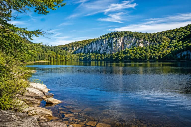
5. The Deschutes River Railbed Trail

- Highlights: Stunning route along the Deschutes River canyon, multiple campsites for backpacking.
- Length: 17 miles
- Surface: Gravel
- Activities: Mountain Biking, Hiking, Horseback Riding, Fishing, Cross Country Skiing
- Start Point: Fulton Canyon Road: Google Maps
- End Point: Deadend, no access: Google Maps
The blue waters of the Deschutes River, which flows through the canyon and into the Columbia River, pierces the typical desert hills of eastern Oregon.
Here, you may encounter some wildlife animals such as deer and bighorn sheep. There might even be some rattlesnakes, so be sure to stay alert throughout your journey.
Although the trail isn’t paved, the majority of the ground is very firm. But it is best traversed with a mountain bike since it’s a challenge for slim road tires.
There is also no shade along the route, so early hikes are recommended. Bring a lot of water and a headcover to your trip.
6. Fanno Creek Greenway Trail

- Highlights: Excellent urban route with many access points that will eventually connect five cities, perfect for biking, rollerblading, and running.
- Length: 10.5 miles
- Surface: Asphalt
- Activities: Biking, Hiking, Cross Country Skiing, Inline Skating, Wheelchair Accessible
- Start Point: SW Oleson Road: Google Maps
- End Point: Tualatin Community Park: Google Maps
Fanno Creek Greenway is a well-kept trail with mostly flat terrain. You will find a lot of shaded places if the weather gets too hot.
The area can be suitable for both biking and running, but some parts may be challenging to navigate because this urban route crosses multiple roads.
Also, sections of the trail are prone to flooding, but there is always a detour available.
However, Fanno Creek Greenway provides access to nearby parks, reserves, and playgrounds. Stroller-approved, wheelchair accessible, and with multiple access points, the trail is a perfect urban gateway.
7. Gresham Fairview Trail

- Highlights: Short, urban trail in Gresham that connects to Springwater Corridor, views of Mt Hood and Mt St Helens; has multiple access points.
- Length: 3.3 miles
- Surface: Asphalt
- Activities: Biking, Walking, Inline Skating, Wheelchair Accessible
- Start Point: Halsey St and 201st Ave: Google Maps
- End Point: Springwater Corridor Trail: Google Maps
Gresham Fairview Trail has a diverse landscape, including suburban vegetable gardens, industrial yards, and parks.
It features the views of Mt Hood and Mt St Helens and connects to Springwater Corridor – Oregon’s “Hall of Fame” rail trail. Hence, you can always extend your ride or walk.
Although the route is relatively short, it is an essential urban artery for biking, walking, and commuting.
It is hard to imagine Gresham without its Fairview trail.
Related: Best Hiking Trails near Gresham, Oregon
8. Lewis and Clark Commemorative Trail

- Highlights: Flat and easy-to-follow trail that runs along Columbia River, rich in geological features. Deep gravel in places, not recommended for bikes.
- Length: 7 miles
- Surface: Gravel
- Activities: Mountain Biking, Hiking, Horseback Riding
- Start Point: Beach Access Road: Google Maps
- End Point: Hat Rock State Park: Google Maps
This commemorative trail in North East Oregon allows you to retrace the steps of explorers Lewis and Clark.
The trail’s terrain is primarily flat and wide, with a few short sections of narrow, moderately steep grades.
You will also find plenty of wildlife here, including birds of prey like a bald eagle.
Only a few spots along the trail are shaded from the sun, so be sure to bring enough water to quench your thirst.
The views of the sunset and sunrise are simply breathtaking, and you might want to schedule your hike accordingly.
However, the track is not paved and has sections with sand and deep gravel. Hence, coming here on a road bike isn’t a good idea.
9. Logging Road Trail

- Highlights: Quiet and lesser-known trail near Canby. Scenic near Willamette River and more urban at the south end.
- Length: 3.5 miles
- Surface: Asphalt
- Activities: Biking, Hiking, Inline Skating, Wheelchair Accessible
- Start Point: Access via Eco Park: Google Maps
- End Point: S Molalla Forest Road and 13th Ave: Google Maps
Logging Road Trail is a partly wild, partly urban route that starts at the Willamette River but then runs through the Canby.
Throughout its entire 3.5-mile length, the trail is relatively flat apart from a section near the big bridge.
The whole route is paved, making it easy to navigate and enjoy biking and rollerblading.
Aside from the beautiful scenery, there are many places to rest and grab some food after your adventure.
10. OC&E Woods Line State Trail

- Highlights: 10th longest rail-trail in America, has a few urban sections but primarily wild and remote.
- Length: 109.9 miles
- Surface: Gravel/ Asphalt
- Activities: Biking, Hiking, Cross Country Skiing, Inline Skating, Wheelchair Accessible, Horseback Riding
- Start Point: Shasta Way, Klamath Falls: Google Maps
- End Point: Gerber Ranch Road, Bly: Google Maps
- 2nd End Point: Thompson Reservoir: Google Maps
OC&E Woods Line State is the longest trail and the longest linear park in Oregon. At almost 110 miles, the route offers a variety of sections and conditions.
For example, Kalamath to Olene section is paved and offers wheelchair access as well as rollerblading and skating opportunities.
At the same time, Beatty to Thompson Reservoir section is entirely wild, remote, and dry. It is boasting of wildlife, and an expedition there has to be thoroughly planned.
The scenery changes dramatically depending on the section. Yet, some of the highlights are the views of Mt Shasta, scenic backcountry landscapes, and open valleys.
It doesn’t matter if you are backpacking, biking casually, or taking a family outdoors; OC&E Woods Line State trail offers the perfect gateway.
11. Row River Trail

- Highlights: Charming, well-maintained trail with covered bridges and lake views.
- Length: 17 miles
- Surface: Asphalt
- Activities: Biking, Hiking, Inline Skating, Horseback Riding, Wheelchair Accessible
- Start Point: E Main St, Cottage Grove: Google Maps
- End Point: Row River Road, Culp Creek: Google Maps
Beautiful covered bridges, wooded hillsides, rivers, flowers, and the reservoir are just a few things that make the Row River Trail special. It is the most charming trail on the list.
The route is very scenic and features Dorena Lake, which is a destination of its own. You can swim, hike, kayak, and fish here.
The entire trail is paved, making it a perfect destination for rollerblading and skating, as well as wheelchair users.
Another great thing about the route is that it runs in the shade for most of the way, providing for an excellent summer gateway.
12. Springwater Corridor

- Highlights: “Hall of Fame” rail-trail in Portland. Scenic, urban and popular.
- Length: 21.5 miles
- Surface: Asphalt
- Activities: Biking, Hiking, Cross Country Skiing, Inline Skating, Horseback Riding, Wheelchair Accessible
- Start Point: SE Ivon St, Portland: Google Maps
- End Point: SE Richey Road, Boring: Google Maps
Springwater Corridor is Oregon’s “Hall of Fame” rail trail that runs from the heart of Portland to Boring.
Despite its urban location, the route offers plenty of wildlife. You can spot deer, coyotes, raccoons, and opossums, to name just a few. Plus, there are a plethora of bird species here, including kingfishers, warblers, and flycatchers.
Another great thing about Springwater Corridor is that it provides access to many parks, wetlands, and nature reserves. What a great way to explore Portland!
Also, the track is 100% paved, separated from the roads in most cases, yet provides multiple access points. Meaning it is perfect for wheelchair users, strollers, skating, and rollerblading, as well as the usual biking and walking.
When it comes to scenery, the trail doesn’t disappoint either, as you can observe Mt Hood for most of the way.
13. Trolley Trail

- Highlights: Excellent neighborhood trail that runs from Milwaukie to Gladstone. Lovely views of the Willamette River.
- Length: 6 miles
- Surface: Asphalt
- Activities: Biking, Hiking, Inline Skating, Horseback Riding, Wheelchair Accessible
- Start Point: Milwaukie Bay Park: Google Maps
- End Point: Portland Ave, Gladstone: Google Maps
Trolley Trail is another fantastic urban route that connects Milwaukie with Gladstone.
The northern part of the trail is very scenic, with excellent views of the Willamette River. At the same time, the southern part is a well-maintained suburbian artery perfect for sports and recreation.
You can easily connect Trolley Trail to Springwater Corridor to extend your workout or for commuting. This creates a traffic-free 25-miles route through the city.
The mostly flat and paved trail is ideal for families and riders looking for a relaxing ride through picturesque parks and charming urban neighborhoods.
Final Thoughts
With only 24 rail-trails, Oregon is far from the “rails-to-trails” leaders.
However, the Beaver State offers the 10th longest rail-trail (#10) and a “Hall of Fame” trail (#12), which is more than most states.
The above list of the highest-rated rail-trails provides a diverse range of some of the best Oregonian routes. Hopefully, a few of these are on your bucket list now.
More Trails in Oregon:
Lakes in Oregon:
Parks in Oregon: