The lakes in the immediate vicinity of Springfield are few. They supply water to the city, limiting recreational activities to fishing and, in some cases, paddling and boating.
However, those prepared to drive for about an hour are spoiled for choice, as Springfield is surrounded by the biggest and most popular reservoirs in Missouri.
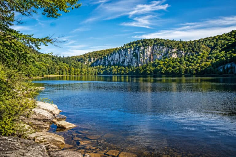
These large lakes have dozens of parks and recreation areas and offer swimming, boating, and camping, just to name a few.
Between them, these large reservoirs hold over 15 fish state records, making Springfield a dream for anglers.
Check out what the area has to offer!
Lakes near Springfield:
- McDaniel Lake
- Fellows Lake
- Lake Springfield
- Pomme de Terre Lake
- Bennett Spring
- Stockton Lake
- Lake Niangua
- Lake of the Ozarks
- Truman Reservoir
- Table Rock Lake
- Lake Taneycomo
- Bull Shoals Lake

1. McDaniel Lake

- Website: McDaniel Lake
- Distance from Springfield: 7 miles (15 min)
- Activities: Fishing, Picnics, Hiking
Located seven miles north of downtown Springfield, McDaniel Lake came into existence after crews constructed a dam along a portion of the Little Sac River in 1929.
Water from the Little Sac flows westward into Fellows Lake. After leaving that body of water, the next section of the Little Sac flows into the northeast corner of the 300-acre McDaniel Lake.
Both McDaniel Lake and Fellows Lake serve as drinking water sources for the city. To protect the integrity of the water within these lakes, officials prohibit any direct contact with the lakes through wading, swimming, or water skiing. Workers raised the level of the dam along McDaniel Lake in 1992 to increase the size of the reservoir.
Although boats and other watercraft are prohibited from using McDaniel Lake, anglers may fish along the embankment in an area of the lake upstream from the Grant Street Bridge.
Those who cast a line from the shore try their luck at catching carp, white crappie, channel catfish, largemouth bass, smallmouth bass, white bass, and sunfish.
2. Fellows Lake

- Website: Fellows Lake
- Distance from Springfield: 13 miles (20 min)
- Activities: Fishing, Boating, Kayaking, Canoeing, Picnics, Hiking
Located 13 miles north of Springfield, Fellows Lake took shape after crews impounded a section of the Little Sac River in 1955 as a source of drinking water for Springfield.
An 860-acre reservoir, Fellows Lake has also grown into a popular recreation site with trails and great fishing spots.
Compared to McDaniel Lake, recreational rules at this reservoir are liberal. Kayaking, canoeing, and boating are popular ways to explore the lake. Motorized boats are limited to 40 hp.
Fellows Lake’s fish population attracts anglers from throughout the region. Muskies are becoming a top catch, though bluegill, bass, walleye, crappie, and catfish are also frequently caught.
3. Lake Springfield
- Website: Lake Springfield
- Distance from Springfield: 10 miles (20 min)
- Activities: Fishing, Boating, Kayaking, Canoeing, Paddleboarding, Picnics, Hiking
A drive just 10 miles south of downtown allows visitors to enjoy Lake Springfield. Designed as an artificial lake along the James River in 1957, the impoundment served the cooling needs for a local power plant for the city of Springfield.
Although the James River Power Station closed in 2021, the 318-acre reservoir continues to offer a variety of recreational activities for those who come to the area.
The Missouri Department of Conservation built a fishing dock, platforms, and a boat ramp in the early 1990s. With more than 150 acres, Lake Springfield Park includes trails and extended shoreline access. A boathouse serves as a special events venue and offers boat rentals.
Anglers will enjoy the fishing opportunities Lake Springfield offers. Notable species found in this reservoir include bass, crappie, catfish, bluegill, and sunfish.
4. Pomme de Terre Lake
- Website: Pomme de Terre Lake
- Distance from Springfield: 45 miles (55 min)
- Activities: Fishing, Swimming, Boating, Kayaking, Canoeing, Paddleboarding, Picnics, Hiking, Biking, Camping, Wakeboarding, Water Skiing, Tubing
Forty miles north of the city, Pomme de Terre Lake is a destination for those who enjoy fishing and other water recreation activities.
The US Army Corps of Engineers impounded a section of the Pomme de Terre River in 1961, establishing a 7,800-acre reservoir that can expand to more than double that size during extreme periods of flooding.
Literally “apple of the earth” in French, the name “Pomme de Terre” means “potato” and may refer to the potato-like plants early French explorers noticed that are common in the area.
Rugged hills and rolling plains are found within Pomme de Terre State Park, a year-round outdoor recreation destination. Campgrounds, trails, swimming beaches, boat ramps, and picnic areas welcome visitors to the various sites managed within this park.
Federally-operated campgrounds and day-use sites such as Lightfoot Landing, Wheatland Park, and Outlet Park offer access to the reservoir and nearby natural sites.
Anglers who access the lake from boat launches, marinas, or along the bank will find a variety of fish. Common species include walleye, crappie, catfish, bass, and muskellunge.
5. Bennett Spring

- Website: Bennett Spring
- Distance from Springfield: 58 miles (1hr 5min)
- Activities: Fishing, Kayaking, Canoeing, Picnics, Hiking, Biking, Camping
Approximately 55 miles northeast of Springfield, Bennett Spring attracted anglers long before the state acquired the spring and some surrounding terrain in the mid-1920s to create Bennett Spring State Park.
During the New Deal in the 1930s, workers with the Civilian Conservation Corps built shelters, trails, cabins, and a rustic dining lodge. Visitors today can stay overnight at campgrounds, an on-site motel, or cabins.
The spring emits millions of gallons of cool and clear water each day. State conservation workers have stocked these waters with rainbow trout.
In addition to the relaxing trails and woodlands in the park, those who enjoy fishing can also launch a boat in the park’s northern area, just west of where Bennett Spring flows into the Niangua River.
Although not a lake destination, Bennett Spring is a wildly-popular spot and provides similar water activities to those found on lakes.
6. Stockton Lake

- Website: Stockton Lake
- Distance from Springfield: 40 miles (55 min)
- Activities: Fishing, Swimming, Boating, Kayaking, Canoeing, Paddleboarding, Picnics, Hiking, Camping, Wakeboarding, Waterskiing, Tubing, Scuba Diving
A little more than 40 miles north-northwest of Branson, Stockton Lake is a pleasant location to enjoy a boat ride while viewing rock formations rising along the shoreline.
Created when the US Army Corps of Engineers impounded a section of the Sac River in 1970, this 24,900-acre reservoir offers boaters and sailors a great place to fish, waterski, and scuba dive.
Stockton State Park sits along a portion of this lake. Many use the docks and launches as a year-round starting point for their water adventures. Campsites are also available.
Fish commonly caught in the lake include bass, crappie, catfish, walleye, and bluegill, with quiet coves throughout the reservoir for those who want to fish in a more secluded area.
Record catches in Missouri have happened in this lake. A 2 lbs. 2 oz. green sunfish in 1971, an 18 lbs. 9 oz. northern pike in 1975, and a 7 lbs. 2 oz. smallmouth bass in 1994 came from Lake Stockton.
7. Lake Niangua

- Website: Lake Niangua
- Distance from Springfield: 71 miles (1hr 25min)
- Activities: Fishing, Kayaking, Canoeing, Paddleboarding, Picnics
Lake Niangua is a drive 70 miles north-northeast of Springfield. In this area, the Niangua River that has already drifted past Bennett Spring continues on a northward journey and gets slightly deeper due to other springs.
A section of this still shallow river flows through a “tunnel” similar to rocky narrows along a natural ridge.
During the early 1900s, interest in generating hydroelectricity came to the region, encouraging some modification of this tunnel cave and the construction of a dam. Turbines started generating power along the river beginning in the 1930s.
This 360-acre reservoir includes a boat launch on its western side, a short distance upriver (south) of the dam. Perfect for smaller boats, canoes, and kayaks, this area is a great place to experience a secluded, wooded area of southern Camden County. Those who fish in this lake will find catfish and bass.
8. Lake of the Ozarks

- Website: Lake of the Ozarks
- Distance from Springfield: 87 miles (1hr 30min)
- Activities: Fishing, Swimming, Boating, Kayaking, Canoeing, Paddleboarding, Picnics, Hiking, Biking, Camping, Wakeboarding, Water Skiing, Tubing
Unlike many 20th-century impoundments created by the US Army Corps of Engineers, the creation of the Lake of the Ozarks occurred when the Union Electric Company built a dam that filled low-lying land in 1931.
With a surface area that spans approximately 54,000 acres, the lake created to generate power has turned into a recreation and tourism powerhouse in central Missouri.
Designed by impounding the Osage River, this reservoir also includes other tributaries, such as the Niangua River.
The stable shoreline has led to the construction of more than 70,000 dwellings and vacation homes along a waterfront that attracts more than five million visitors each year.
The Lake of the Ozarks State Park took shape as a Civilian Conservation Corps project in the mid-1930s, with the state taking over management in 1946.
This year-round park offers numerous outdoor recreation activities that span from fishing and boating to camping and hiking. In addition to the many land and water activities, the park also offers underground cave tours.
As of 2022, the lake holds six fish records in Missouri. Those who fish in the Lake of the Ozarks will find a variety of favorite spots to cast a line. Fish they may encounter include walleye, catfish, bass, and bluegill.
9. Truman Reservoir

- Website: Truman Reservoir
- Distance from Springfield: 75 miles (1hr 25min)
- Activities: Fishing, Swimming, Boating, Kayaking, Canoeing, Paddleboarding, Picnics, Hiking, Biking, Camping, Wakeboarding, Water Skiing, Tubing
A drive of approximately 80 miles north to Warsaw offers an opportunity to enjoy a visit to the Truman Reservoir.
Also known as Truman Lake, this substantial impoundment of the Osage River took shape with the construction of the Harry S. Truman Dam in the mid-1970s.
The 55,000-acre reservoir was originally designated as the Kaysinger Bluff Dam and Reservoir during initial planning in the 1950s. The impressive Harry S. Truman Visitor Center welcomes visitors during its summertime operating hours.
In 1983, Missouri opened Harry S. Truman State Park as a popular camping and recreation site on a peninsula surrounded by the reservoir.
Camping, hiking, fishing, and boating opportunities are found at this park and federal recreation sites along Truman Reservoir.
Bass, bluegill, and channel catfish are abundant, with two fish state records.
10. Table Rock Lake

- Website: Table Rock Lake
- Distance from Springfield: 54 miles (1 hr)
- Activities: Fishing, Swimming, Boating, Kayaking, Canoeing, Paddleboarding, Picnics, Hiking, Camping, Wakeboarding, Water Skiing, Tubing, Scuba Diving
Table Rock Lake is a massive 43,100-acre reservoir near Branson. It’s a nation-famous vacation spot and a water playground like no other.
With over 850 miles of shoreline, it has no shortage of beaches, parks, resorts, marinas, and recreational areas. The choice will depend on how much one is prepared to spend or drive.
The nearest spot to Branson is Table Rock State Park – an all-in-one destination for lakegoers. It has a marina with boat rentals, campgrounds, and miles of hiking trails.
Like other large reservoirs in Missouri, this lake offers every activity imaginable, and fishing here is incredible. Table Rock Lake is a one-time state record holder in Arkansas and three-time in Missouri, including the monster record for 139lbs 4oz paddlefish.
With over 25 fish species on offer, it’s a fun lake for anglers. However, it takes time to learn its character, depths, and patterns.
11. Lake Taneycomo

- Website: Lake Taneycomo
- Distance from Springfield: 54 miles (1hr 5min)
- Activities: Fishing, Swimming, Boating, Kayaking, Canoeing, Paddleboarding, Picnics, Hiking, Camping, Wakeboarding, Waterskiing, Tubing
Alongside downtown Branson and the immediate area, Lake Taneycomo was first formed in 1913. Crews built a hydroelectric dam along the White River at Powersite, east of Branson.
This downriver dam brought power to the region and created a reservoir that had the characteristics of a warm-water lake. Situated in Taney County, MO, the lake’s name is a portmanteau for its location.
The lake’s nature changed to a more cold-water flow after the construction of Table Rock Dam in 1958 at the lake’s headwaters. The 2,078-acre reservoir that maintains its riverlike appearance soon became Missouri’s coldest lake.
Although interest in summertime swimming in the lake declined after tailwater from Table Rock Lake flowed into Lake Taneycomo, the increasing popularity of tourist destinations in and around Branson has sustained water activities along the lake’s shoreline that stretches for 40 miles.
With all of the lakeside activities at resorts, campgrounds, and marinas, much of Branson’s commercial activity is centered around Lake Taneycomo.
A popular part of that tradition involves fishing for brown and rainbow trout, along with bluegill, catfish, and bass. Missouri’s record brown trout (40 lbs. 6 oz) was caught here in 2019.
12. Bull Shoals Lake

- Website: Bull Shoals Lake
- Distance from Springfield: 54 miles (1hr 5min)
- Activities: Fishing, Swimming, Boating, Kayaking, Canoeing, Paddleboarding, Picnics, Hiking, Camping, Wakeboarding, Waterskiing, Tubing
Located further downriver from Lake Taneycomo and straddling the Missouri-Arkansas state line, Bull Shoals Lake is the last artificial lake along the White River built for flood control. Lake Taneycomo, Table Rock Lake, and Beaver Lake sit above this reservoir.
Prior to the completion of the Bull Shoals Dam in 1951, workers exhumed burials from family and community cemeteries near the White River.
Nearly all of the 700-mile shoreline of Bull Shoals Lake remains undeveloped. This 45,000-acre reservoir is mostly surrounded by forests that attract a variety of wildlife.
Lakefront destinations offer opportunities for camping and recreation. The Drury-Mincy Conservation Area has preserved the local deer habitat since the late 1930s.
Buck Creek Campground has a campground and picnic areas. It sits on the lake’s north side, in an area where the last state-managed ferry in Arkansas still operates.
Bull Shoals–White River State Park, located 70 miles southeast of Branson in Arkansas, offers campsites, multiple trails, and impressive views from the area near the dam.
Commonly caught fish are bass, catfish, walleye, crappie, bluegill, sunfish, and trout.
This lake holds records for both states, including smallmouth bass (7 lbs. 5 oz., Arkansas) in 1969, spotted bass (7 lbs. 15 oz, Arkansas) in 1983, walleye (21 lbs. 1 oz, Missouri) in 1988, longnose gar (35 lbs. 9 oz., Missouri) in 2013, striped bass (65 lbs, 2 oz, Missouri) in 2015, and yellow perch (2 lbs. 7 oz., Missouri) in 2021.
More Lakes in Missouri: