Williamstown is a fantastic place for hiking. The town has access to Appalachian Trail, Vermont’s Long Trail, and Mount Greylock area, all of which offer amazing opportunities for hiking and backpacking.
Trails near Williamstown:
- Bellows Pipe Trail to Mount Greylock + Cheshire Harbor Trail
- Mount Greylock Overlook Trail (July to Oct)
- Mount Greylock Loop
- The Cascades Trail
- Taconic Crest Trail to Snow Hole
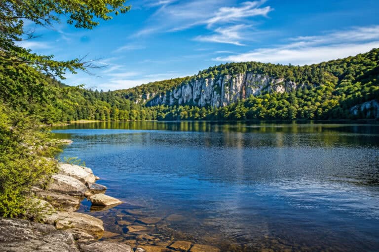
- Pine Cobble Trail
- Hoosac Range Trail to Spruce Hill
- Hopkins Memorial Forest Loop
- March Cataract Falls (July-Oct)
- Appalachian Trail to Prospect Overlook
- The Long Trail
1. Bellows Pipe Trail to Mount Greylock + Cheshire Harbor Trail

- Type: Out and Back
- Trail Length: 5.9 miles
- Elevation Gain: 2,303 ft
- Time to Complete: 3h
- Difficulty: Moderate
- Parking: Trailhead Lot: Google Maps
- Distance from Williamstown: 12 miles (25 min)
- Dog Friendly: Yes
Bellows Pipe Trail is the most popular way to tackle the highest point in Massachusetts – Mount Greylock (3,489ft). From the top, the views are truly stunning. On a clear day, you can see as far as 90 miles in every direction – it’s a must-do hike.
However, this isn’t the easiest option to get to the peak. The trail is a continuous climb with a steep section at the end, and roots and mud add to the challenge. Hiking poles are recommended, especially during wet weather.
The only criticism of this hike is that it gets crowded on the top, with many people driving there, but popular accessible places usually are. Don’t worry though – there are plenty of views for everyone!
If you’ve done this route before, you can try Cheshire Harbor Trail that starts from W Mountian Road and leads to the top. It is very similar in length, elevation, and difficulty.
2. Mount Greylock Overlook Trail (July to Oct)

- Type: Loop
- Trail Length: 2.5 miles
- Elevation Gain: 650 ft
- Time to Complete: 1h
- Difficulty: Moderate
- Parking: Trailhead Lot: Google Maps
- Distance from Williamstown: 8 miles (20 min)
- Dog Friendly: Yes
Mount Greylock Overlook Trail isn’t as scenic as the name suggests. It simply loops on the side of the mountain through the thick forest. The best views are still on the peak. Nevertheless, this is the perfect option to explore the area when driving to the Grey.
The trail’s terrain is rugged with steep sections, mud, and rocks. It takes many people by surprise, but it’s a fun challenge, and you will be glad you’ve done it.
The important detail is that Summit Road is closed for winter (Nov -June), which means you can’t access the trailhead.
3. Mount Greylock Loop

- Type: Loop
- Trail Length: 13 miles
- Elevation Gain: 3,084 ft
- Time to Complete: 7h
- Difficulty: Hard
- Parking: Trailhead Lot: Google Maps
- Distance from Williamstown: 5 miles (12 min)
- Dog Friendly: Yes
Mount Greylock Loop is a combination of trails that connect Mount Williams, Mount Fitch, Mount Greylock, and Stony Ledge before returning to the trailhead. It is a very popular way to explore the area for seasoned hikers.
Typically, the loop is completed as a day hike, but there are a few campsites on the way, so you can easily turn it into a backpacking expedition.
The terrain isn’t as difficult as one may expect, with the length being the biggest challenge. Yet, there are plenty of creek crossings, mud, rocks, and steep sections, so sturdy footwear is recommended as well as the hiking poles for steep, wet descents.
The only downside of the trail is that, for the most part, it runs under the tree canopy, limiting the views. Yet, you get plenty of shade during hot days, and it’s nice to look forward to summiting the peaks where the views of Berkshires are simply breathtaking.
4. The Cascades Trail

- Type: Out and Back
- Trail Length: 2 miles
- Elevation Gain: 381 ft
- Time to Complete: 1h
- Difficulty: Easy
- Parking: YMCA: Google Maps
- Distance from Williamstown: 5 miles (12 min)
- Dog Friendly: Yes
The Cascades Trail is a short and easy hike to a charming waterfall. It runs along the creek and through the woods, making an excellent summer option.
The terrain is typical for the area: some mud, some rocks, and tree roots covered with leaves. Still, there are no steep hills on this route, making it a beginner and family-friendly option.
Although short, it’s a fun destination, and the falls themselves are worth the attention.
5. Taconic Crest Trail to Snow Hole

- Type: Out and Back
- Trail Length: 6.2 miles
- Elevation Gain: 903 ft
- Time to Complete: 3h
- Difficulty: Moderate
- Parking: Petersburg Pass: Google Maps
- Distance from Williamstown: 7 miles (15 min)
- Dog Friendly: Yes
This section of Taconic Crest Trail starts at Petersburg Pass and leads north along the state border. You can hike it for miles, but the most popular destination is Snow Hole – a crevasse-like opening in the ground that you can climb into.
The route runs through the forest, with only a few openings to enjoy the views of the rolling hills around. Apart from that, it’s a walk in the woods with muddy sections, rocks, and a few steep ascents.
6. Pine Cobble Trail

- Type: Out and Back
- Trail Length: 3.4 miles
- Elevation Gain: 1,176 ft
- Time to Complete: 1h 30min
- Difficulty: Moderate
- Parking: Trailhead Lot: Google Maps
- Distance from Williamstown: 2 miles (5 min)
- Dog Friendly: Yes
Pine Cobble Trail is a popular climb to the 1,880-foot mountain with sweeping views of the Berkshires and Williamstown. Like many trails in the area, it is best visited during fall when the hills turn red and golden, providing remarkable scenery.
Although short, the trail is a challenge because of the elevation gain, muddy patches, and rocks. But it is doable and can be an excellent introduction to peaks hiking for beginners.
The downsides of this route are a small parking area and trails popularity, probably due to proximity to Williamstown. Arrive early to secure a spot or avoid weekends.
7. Hoosac Range Trail to Spruce Hill

- Type: Out and Back
- Trail Length: 6.5 miles
- Elevation Gain: 1,004 ft
- Time to Complete: 3h 30min
- Difficulty: Moderate
- Parking: Trailhead Lot: Google Maps
- Distance from Williamstown: 10 miles (20 min)
- Dog Friendly: Yes
Hoosac Range Trail runs along the ridge to a 2,543-foot peak. Although you can continue further, Spruce Hill is the most popular turnaround spot. It features views of the surrounding mountains that are especially pretty in fall.
The trail is narrow in places but not too steep, with a gradual ascent all the way to the top. You can expect rocks, mud, and tree cover – a typical landscape for the area.
Although a popular hike, this trail has nothing to brag about. It is another highly-rated climb, but without any particular features.
8. Hopkins Memorial Forest Loop

- Type: Loop
- Trail Length: 4.4 miles
- Elevation Gain: 630 ft
- Time to Complete: 2h
- Difficulty: Easy
- Parking: Trailhead Lot: Google Maps
- Distance from Williamstown: 2 miles (5 min)
- Dog Friendly: Yes
Hopkins Memorial Forest Loop is a trail that runs through the woods and along Birch Brook. It is very close to Williamsburg and known for its diverse wildlife and birding.
Although the terrain has a few hills, it’s relatively easy and is suitable for all skill levels. The route is very popular with trail runners, too.
Perhaps the best thing about this hike is its serenity. If you need to unwind and recharge your batteries, this is the perfect location to do it.
9. March Cataract Falls (July-Oct)

- Type: Out and Back
- Trail Length: 3 miles
- Elevation Gain: 511 ft
- Time to Complete: 1h 30min
- Difficulty: Moderate
- Parking: Trailhead Lot: Google Maps
- Distance from Williamstown: 10 miles (25 min)
- Dog Friendly: Yes
March Cataract Falls are located in the Mount Greylock area and accessed via Sperry Road and March Cataract Falls Trail. The waterfall is gorgeous, but the flow changes a lot depending on the precipitation. So if you want to see it in full glory, it is best visited after a few rainy days.
The Sperry Road part of the hike is a flat and wide gravel track; it is an access road to a nearby campground. While the trail to the falls is the opposite – it is narrow and steep, with creek crossings and muddy patches.
There is also an alternative way to get to the falls if you want to stick to the trails and avoid Sperry Road. You can park at Campground Trailhead and take the Campground Trail to March Cataract Falls Trail. Although this doubles the distance, the route is more fun as it has narrow trails, creek crossings, and a few cascades.
The downside to these routes is that the road leading to the trailhead (and Mt. Greylock) is closed during winter. So, this hike can only be completed in summer and fall.
10. Appalachian Trail to Prospect Overlook

- Type: Out and Back
- Trail Length: 4.4 miles
- Elevation Gain: 1,611 ft
- Time to Complete: 2h 30min
- Difficulty: Hard
- Parking: Trailhead Lot: Google Maps
- Distance from Williamstown: 4 miles (10 min)
- Dog Friendly: Yes
Hiking to Prospect Overlook is an excellent challenge. The trail is a continuous climb with well-maintained switchbacks that leads to the intersection towards Mt Greylock. This is where the overlook is, which is the only chance to enjoy the views along this route.
Most people turn back here, but you can continue to Mount Prospect (no views), turn towards Mt. Greylock, or visit Mount Williams (no views). Lot’s of options here, and the trailhead is very close to Williamstown.
11. The Long Trail

- Type: Point to Point
- Trail Length: 273 miles
- Elevation Gain: 70,000 ft
- Time to Complete: 20-22 days
- Difficulty: Hard
- Parking: Trailhead Lot: Google Maps
- Distance from Williamstown: 2 miles (5 min)
- Dog Friendly: Yes
Vermont’s Long Trail is the oldest long-distance trail in America. It runs along the Green Mountain range from a MA state line to the Canada border. On average, thru-hikers complete this route in 20 days, averaging 13.6 miles a day.
There are many guides about taking on this challenge. For example, Cam’s post is an excellent summary of everything you need to know, including resupply points and links to more resources. Also, Green Mountain Club is an organization dedicated to the maintenance of the trail and provides local information.
Getting to the trailhead of the Long Trail is a hike in its own right. The best way is to continue on the Pine Cobble Trail (#6) to the Vermont border or join the Appalachian Trail at Massachusetts Ave. Both ways are about 7.5 miles return trips.
Final Thoughts
With so many hiking landmarks at the doorstep, Williamstown is a fantastic gateway to trails. Hopefully, you found a few exciting options on this list and can’t wait to go!
And if you need some motivation to get going, try these hiking quotes – we all need some inspiration sometimes!