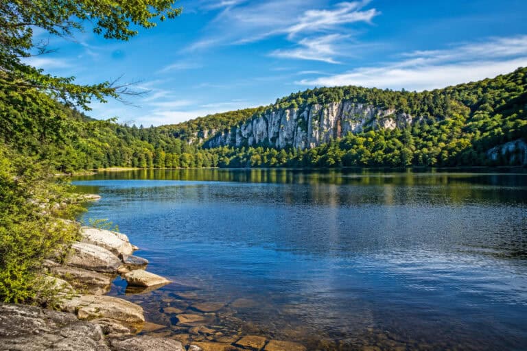
If there was a ranking for the town with the best hiking trails, Dillon would undoubtedly be at the top. It is simply mindboggling how many stunning routes the area offers.
Dillon’s elevation is 9,115ft (2,778m). Most of the trails here are moderate and hard, with only a few easy options on the list, limiting the choice for beginners and families with small kids. Yet, Dillon is the must-visit hiking destination for experienced climbers.
Hiking Trails near Dillon:
- Lily Pad Lake Trail
- North Ten Mile Trail
- Sapphire Point Overlook Trail
- Mountain Sniktau Trail
- Dillon Nature Preserve Loop
- Ptarmigan Trail
- B&B and Minnie Mine Trails Loop
- Mount Royal Trail
- Buffalo Mountain Trail
- Gore Range Trail to Willow Lakes
- Grizzly Peak and Cupid Peak from Loveland Pass
- Chihuahua Gulch Lake Trail
- Willow Creek Falls from Willowbrook
- Tenderfoot Mountain Trail
- Peaks Trail
- Miners Creek Road Loop
- Lakeshore Perimeter Trail
- Grays Peak and Torreys Peak
- The Decalibron: Four 14ers Loop
1. Lily Pad Lake Trail

- Highlight: Short, easy, and popular route to the beautiful lake; family-friendly and perfect for hiking and running.
- Type: Out and Back
- Trail Length: 3.5 miles
- Elevation Gain: 401 feet
- Time to Complete: 2h
- Difficulty: Easy
- Parking: Trailhead Lot: Google Maps
- Distance from Dillon: 5 miles (15 min)
- Dog Friendly: Yes
Lily Pad Lake Trail is a 3.5 mile out and back route near Silverthorne, best used for hiking, running, and dog walking.
It’s an easy trail for all skill levels with just 401ft of elevation gain. The path is incredibly well signposted, so finding the way to Lily Pad Lake isn’t an issue.
This trail snakes through the Eagles Nest Wilderness, passing beaver ponds, Lake Dillon, and has fantastic views of Buffalo Mountain. But it’s the stunning views of Lily Pad Lake that make this trip so popular.
The main complaint from hikers is that the route becomes icy and muddy during the winter, making it much harder to pass.
Either bring sensible footwear or hike on warmer days to avoid this. This easy-to-follow, well-maintained route is excellent for all the family and a lot of fun to boot.
Related: 11 Gorgeous Recreational Lakes near Breckenridge, CO
2. North Tenmile Trail

- Highlight: Beautiful rocky trail along the creek with an anticlimactic endpoint; rocky terrain that gets slippery but not too steep.
- Type: Out and Back
- Trail Length: 7.6 miles
- Elevation Gain: 947 feet
- Time to Complete: 4h
- Difficulty: Moderate
- Parking: Trailhead Lot: Google Maps
- Distance from Dillon: 6 miles (15 min)
- Dog Friendly: Yes
North Tenmile Trail is a 7.6 mile out and back route near Frisco, best used for nature trips, hiking, and running.
The trail is moderate in difficulty with a 947ft of elevation gain. It’s a muddy, rocky path, but it’s still reasonably easy to navigate when not icy or wet.
Following the North Tenmile Creek, this trail is a brilliant spot for hikers to connect with nature and experience Eagle Nest Wilderness.
The biggest problem with this trail is the turnaround point, which is anticlimactic. It’s simply the junction of the Gore Range Trail.
However, the route itself is a lot of fun and very peaceful. And there’s even a designated lunch spot around halfway through, by the creek. It’s well-maintained, simple to follow, and very relaxing.
3. Sapphire Point Overlook Trail

- Highlight: Very short yet highly-rated overlook trail with stunning views of the reservoir and the nearby peaks; great for workouts.
- Type: Loop
- Trail Length: 0.6 miles
- Elevation Gain: 41 feet
- Time to Complete: 30 min
- Difficulty: Easy
- Parking: Trailhead Lot: Google Maps
- Distance from Dillon: 6 miles (10 min)
- Dog Friendly: Yes
Sapphire Point Overlook Hike is a 0.6-mile loop near Frisco, used primarily for running, walking, and hiking.
This short trail is easy, with a barely noticeable 41ft elevation gain.
The Sapphire Point trail overlooks the Blue River portion of the Dillon Reservoir nearby and is a great lookout spot for nearby peaks you might wish to visit.
Some hikers will complain that this short, easy trail isn’t worth it. But the views and photo opportunities would argue otherwise.
4. Mountain Sniktau Trail

- Highlight: Stunning but steep scramble to the 13,219-foot peak with killer views; one of the highest-rated hikes in the area.
- Type: Out and Back
- Trail Length: 4.1 miles
- Elevation Gain: 1,618 feet
- Time to Complete: 3h
- Difficulty: Hard
- Parking: Grizzly Peak Trailhead: Google Maps
- Distance from Dillon: 15 miles (25 min)
- Dog Friendly: Yes
Mountain Sniktau Trail is a 4.1 mile out and back climb near Dillon, best used for hiking, scrambling, and snowshoeing in the winter.
This trail is challenging, with an elevation gain of 1,618ft. However, it’s one of the best hikes for mountain scenery.
Mount Sniktau isn’t quite a 14er, with a peak at 13,219ft, but it still offers impressive views of the surrounding mountains and peaks.
The only complaint about this trail is that the first mile is the most challenging, which can tire you out before reaching the summit.
Still, this route is well-marked, and the scramble to the peak is steep and challenging. But the rewards at the top are breathtaking.
Related: 11 Gorgeous Recreational Lakes near Breckenridge, CO
5. Dillon Nature Preserve Loop

- Highlight: Short and scenic loop with lookouts over the reservoir and stunning mountain views; great for running and hiking.
- Type: Loop
- Trail Length: 3.3 miles
- Elevation Gain: 474 feet
- Time to Complete: 1h 30min
- Difficulty: Easy
- Parking: Trailhead Lot: Google Maps
- Distance from Dillon: 3 miles (5 min)
- Dog Friendly: Yes
Dillon Nature Preserve Loop is one of the more accessible trails near Dillon. The 3.3-mile loop is perfect for hiking and running.
The trail is easy for all skill levels, with 474ft of elevation. It’s also partially paved and great for kids.
This trail follows Meadow Loop at first, passing the stunning Dillon Reservoir. The trail then continues along the Ridge Trail overlooking the Snake River, so there are plenty of beautiful sights nearby, including mountains.
The biggest complaint about this trail is that the Meadow Loop Trail isn’t as interesting as the Ridge Trail, but they both offer different views.
It’s well-developed and well-maintained throughout, as most would expect from a Nature Preserve, and the wide path is easy to follow.
6. Ptarmigan Trail

- Highlight: Steady climb to the ridge with sweeping views of Silverthorne and the reservoir; exposed and wooded sections; superb aspens in fall.
- Type: Out and Back
- Trail Length: 4.7 miles
- Elevation Gain: 1,201 feet
- Time to Complete: 2h 30min
- Difficulty: Moderate
- Parking: Trailhead Lot: Google Maps
- Distance from Dillon: 3 miles (10 min)
- Dog Friendly: Yes
Ptarmigan Trail is a 4.7 mile out and back route near Silverthorne. It’s perfect for hiking, dog walking, and nature trips.
It’s a moderate hike, with 1,201ft of elevation. The incline is constant to the ridge, which can be tiring for some.
This trail offers impressive views over Silverthorne and Dillon Reservoir. Also, there’s an excellent bench overlook at the turnaround point that offers stunning views in all directions, including nearby Blue River and its many lakes.
Apart from a few poison ivy plants, there aren’t any criticisms of the route.
The trail is well signposted, but it is difficult to follow in parts because of occasional fallen trees. It’s a well-maintained spot, though, so these never take too long to clear.
7. B&B and Minnie Mine Trails Loop

- Highlight: Fun hike through historical gold mines with some mining equipment, creeks, and beautiful views; many more trails in the area.
- Type: Loop
- Trail Length: 3.1 miles
- Elevation Gain: 417 feet
- Time to Complete: 1h 30min
- Difficulty: Moderate
- Parking: Trailhead Lot: Google Maps
- Distance from Dillon: 16 miles (30 min)
- Dog Friendly: Yes
B&B and Minnie Mine Trails is a 3.1-mile loop near Breckenridge that’s great for hiking and running.
The trail is moderate with 417ft of elevation. The path can be a little muddy, but with hiking boots, this isn’t a problem.
Both trails offer superb views over the French Gulch, and the B&B Mine Trail provides terrific views of the historical gold mines and old mining equipment, as well as Reiling Dredge – where the barge-like gold mining derelict still stands today.
Some hikers complain that the heavily trafficked trail becomes too crowded, and parking is difficult. Head here early to beat the crowds.
Both trails are well-maintained, with clear signposts showing the way to go. This is lucky because this hike takes place in an area filled with several other tracks!
Related: 11 Gorgeous Recreational Lakes near Breckenridge, CO
8. Mount Royal Trail

- Highlight: Very steep climb to the 10,499-foot peak; killer views, aspen groves, and solid workout; top-rated hike.
- Type: Out and Back
- Trail Length: 3.8 miles
- Elevation Gain: 1,400 feet
- Time to Complete: 2h 30min
- Difficulty: Hard
- Parking: Trailhead Lot: Google Maps
- Distance from Dillon: 6 miles (15 min)
- Dog Friendly: Yes
Mount Royal Trail is a 3.8 mile out and back climb near Frisco, best used for hiking and running when looking for an intense workout.
The trail is challenging and has a 1,400ft of elevation gain. Some parts of the path become slick when wet or icy, so bring sensible footwear.
The route offers a stunning aspen-filled climb to the 10,499ft peak of Mount Royal. From here, views over Frisco are amazing and picture-perfect on a clear day.
Hikers mainly complain about the decline, which is very tough and may require spikes in winter to navigate safely.
Overall, it’s a well-maintained trail to the peak. Although the gravel can be slippy, it is a simple route to follow because it’s so well kept. The challenge is that it’s heading towards a 10,499ft peak.
9. Buffalo Mountain Trail

- Highlight: Stunning and grueling hike to the 12,750-foot summit with a boulder field to navigate, but killer views are worth the effort.
- Type: Out and Back
- Trail Length: 6.7 miles
- Elevation Gain: 3,101 feet
- Time to Complete: 4h
- Difficulty: Hard
- Parking: Trailhead Lot: Google Maps
- Distance from Dillon: 5 miles (15 min)
- Dog Friendly: Yes
Buffalo Mountain Trail is a 6.7 mile out and back trail near Silverthorne, mainly used for hiking, nature trips, and bird watching.
This trail is very hard, with a 3,101ft elevation gain. The route is rocky and requires some scrambling to reach the summit.
Climbing to the impressive 12,750ft summit of Buffalo Mountain is not for the faint-hearted, but the views are second to none. Peaks and mountain views are incredible, and so too are the ones of Dillon Reservoir.
The biggest challenge here is scrambling over the boulder field to continue the route. The descent from them is tricky and can feel sketchy and slippery in places.
This trail is rewarding and very clear to follow, but it is a grueling and difficult one, best left to experienced hikers who are confident in their abilities.
10. Gore Range Trail to Willow Lakes

- Highlight: Gorgeous, strenuous hike to the stunning alpine lakes; a highly-rated option for experienced hikers.
- Type: Out and Back
- Trail Length: 12 miles
- Elevation Gain: 2,724 feet
- Time to Complete: 6h
- Difficulty: Hard
- Parking: Trailhead Lot: Google Maps
- Distance from Dillon: 5 miles (15 min)
- Dog Friendly: Yes
Gore Range Trail to Willow Lakes is a 12 mile out and back trail near Silverthorne, primarily used for backpacking, camping, and hiking.
It’s a challenging trail, with an elevation gain of 2,724ft, best left to experienced hikers.
The trail has everything from beautiful golden aspens, pines, streams, and boulders for scrambling. The alpine meadow and Willow Lakes are gorgeous, and the turnoff to Salmon Lake is worth it, too, if you still have the energy after the hike up.
Some hikers complain that there aren’t many views through the alpine forests, and that’s true. But the lakes are worth the strenuous hike alone.
This trail is easy to follow and is clearly marked, but the incline is tiring and the descent slippery when cold and wet, so be mindful.
Related: 11 Gorgeous Recreational Lakes near Breckenridge, CO
11. Grizzly Peak and Cupid Peak from Loveland Pass

- Highlight: Two-in-one hike to the gorgeous peaks above the treeline; killer views and superb workout; ideal for experienced hikers.
- Type: Out and Back
- Trail Length: 6.9 miles
- Elevation Gain: 2,640 feet
- Time to Complete: 4h
- Difficulty: Hard
- Parking: Grizzly Peak Trailhead: Google Maps
- Distance from Dillon: 15 miles (25 min)
- Dog Friendly: Yes
Grizzly Peak and Cupid Peak from Loveland Pass is a 6.9 mile out and back trail and one of the most grueling trails near Dillon. It’s perfect for hiking and birdwatching.
A strenuous hike, with 2,640ft elevation, it reaches both Grizzly and Cupid Peaks, making this a challenge even for experienced hikers.
This trail climbs first to Cupid Peak, standing at 13,117ft, before continuing to Grizzly Peak, which is slightly taller at 13,334ft. Views from both are gorgeous, but Grizzly Peak offers the most panoramic views of the other nearby mountains and peaks.
The only complaint about this trail is that it’s exposed to the elements, so trusted gear is recommended on windy days.
The trail itself is easy to follow, although the section between Cupid and Grizzly requires scrambling and is tiring. The smaller peaks between Cupid and Grizzly are also worth stopping and taking in the views at too.
12. Chihuahua Gulch Lake Trail

- Highlight: Highly-rated hike to the alpine lake with panoramic views, steep sections, and valleys.
- Type: Out and Back
- Trail Length: 8 miles
- Elevation Gain: 1,910 feet
- Time to Complete: 4h 30min
- Difficulty: Hard
- Parking: Trailhead Lot: Google Maps
- Distance from Dillon: 14 miles (30 min)
- Dog Friendly: Yes
Chihuahua Lake Trail is an 8 mile out and back route and one of many impressive trails near Dillon. This is a perfect option for hiking, snowshoeing, and cross-country skiing in winter.
It’s another challenging route with 1,910ft of elevation gain throughout. Some sections are very rocky and require scrambling to continue forward.
The trail winds past many scenic alpine lakes and looks down at the valleys below. It also has terrific panoramic views at Chihuahua Lake. Grizzly Peak is an impressive sight from here, too.
The biggest complaint about this trail is the final push to the lake, which is a rock scramble and can be difficult. Hiking poles are a great help, though.
The route is testing, but it’s made easier by flatter sections where you can catch your breath. The inclines at the beginning, middle, and end, though, are enough to challenge even experienced hikers.
13. Willow Creek Falls from Willowbrook

- Highlight: Beautiful, moderate hike to the charming falls; gradual incline with forested and exposed sections.
- Type: Out and Back
- Trail Length: 7.3 miles
- Elevation Gain: 1,100 feet
- Time to Complete: 4h
- Difficulty: Moderate
- Parking: Trailhead Lot: Google Maps
- Distance from Dillon: 5 miles (15 min)
- Dog Friendly: Yes
Willow Creek Falls is a 7.3 mile out and back trail near Silverthorne, best used for hiking and nature trips.
It’s a moderate trail with a 1,100ft elevation gain. It becomes icy in winter, which makes it more difficult.
The trail leads to the charming Willow Creek Falls and follows the stunning South Willow Creek on the way.
There’s a nice balance between shaded and open areas, but this also means sun protection and wind protection are necessary depending on the time of year.
The whole trail is unique, but the last half towards the Falls really feels terrific. The beautiful Willow Creek Falls make the incline towards it worthwhile.
Related: 11 Gorgeous Recreational Lakes near Breckenridge, CO
14. Tenderfoot Mountain Trail

- Highlight: Local hike to the 11,444-foot peak with fun switchbacks, aspen and pine woods, and killer views of the reservoir.
- Type: Out and Back
- Trail Length: 11.5 miles
- Elevation Gain: 2,500 feet
- Time to Complete: 6h
- Difficulty: Hard
- Parking: Trailhead Lot: Google Maps
- Distance from Dillon: 1 mile (5 min)
- Dog Friendly: Yes
Tenderfoot Mountain Trail is an 11.5 mile out and back route near Silverthorne, primarily used for hiking and birdwatching.
The trail is challenging, with 2,500ft of elevation towards the 11,444ft peak of Tenderfoot Mountain.
It isn’t the tallest peak in the area, but Tenderfoot offers impressive uninterrupted views of Dillon Reservoir, and the walk through the aspen and pine-filled woods is special on its own.
Some complain that the route is boring. But while it may be lengthy, the alpine woodland is a genuinely relaxing and beautiful place.
The path is well-maintained throughout, and the switchbacks to the peak are genuinely fun with fabulous views.
15. Peaks Trail

- Highlight: Fantastic, moderate trail with beautiful views; well-kept and perfect for trail running and beginners.
- Type: Point to Point
- Trail Length: 7 miles
- Elevation Gain: 660 feet
- Time to Complete: 3h 30min
- Difficulty: Moderate
- Parking: Trailhead Lot: Google Maps
- Distance from Dillon: 17 miles (30 min)
- Dog Friendly: Yes
Peaks Trail is a 7-mile point-to-point trail near Breckenridge, primarily used for running, camping, and hiking.
This is a moderate hike with just 660ft of elevation gain. It’s muddy in places, so sensible footwear is a must.
The trail follows Miners Creek, which forms charming ponds and mini-lakes along the route. Views of the nearby mountains and peaks are breathtaking.
The main complaint about this trail is that parking at the trailhead is limited, and lots of people head here early because it’s a point-to-point trail that requires shuttling.
If you arrive early enough, then a beautiful forest hike with aspens and pines awaits. Yes, it’s challenging in places, but most people should be able to complete it with a few rest stops.
16. Miners Creek Road Loop

- Highlight: Rainbow Lake, Peaks, and Miners Creek Road loop; the easier alternative to the above; perfect for trail running.
- Type: Lollipop Loop
- Trail Length: 4.8 miles
- Elevation Gain: 590 feet
- Time to Complete: 2h 30min
- Difficulty: Moderate
- Parking: Trailhead Lot: Google Maps
- Distance from Dillon: 7 miles (15 min)
- Dog Friendly: Yes
Miners Creek Road Loop is a 4.8-mile lollipop trail near Frisco. It’s great for hiking, running, and nature trips.
The trail is moderately difficult but only has a 590ft elevation gain. It’s an easier alternative to the route mentioned above.
Starting at Frisco, this trail heads towards Rainbow Lake before passing Miners Creek and the beautiful set of ponds and mini lakes they form. It then crosses Miners Creek and heads back towards Frisco, offering incredible views along the way.
Some hikers complain that the muddy terrain is tough, but hiking poles help, so bring them along to be on the safe side.
This trail is very well signposted, and the route is well-kept, with each path clearly marked and easy to follow, so it’s great for anyone to explore.
17. Lakeshore Perimeter Trail

- Highlight: Easy hike with little elevation gain; stunning lake views; popular with MTBs and trail runners.
- Type: Loop
- Trail Length: 5.5 miles
- Elevation Gain: 250 feet
- Time to Complete: 3h
- Difficulty: Easy
- Parking: Adventure Center Lot: Google Maps
- Distance from Dillon: 7 miles (15 min)
- Dog Friendly: Yes
Lakeshore Perimeter Trail is a 5.5-mile loop near Frisco, best used for dog walking, mountain biking, and running.
This trail is easy for all skill levels and only has an elevation gain of 250ft. It’s a popular route, but it’s only moderately trafficked, so it’s pretty peaceful.
Starting by the Peak One Disc Golf Course, this trail heads past Peak One Campground towards Dillon Reservoir. Stunning views across the Tenmile Creek and Blue River portions of the reservoir are found all along this route.
There are many trails in the area, and not many of them are well-marked, so do some research before heading out to make sure you’re confident about the route.
Besides that, the path itself is well-maintained, and the beautiful views over Dillon Reservoir are a treat for any keen hiker.
Related: 11 Gorgeous Recreational Lakes near Breckenridge, CO
18. Grays Peak and Torreys Peak

- Highlight: The default route to bag two 14ers in one hike; 360-degree, ‘top of the world’ panorama from both peaks.
- Type: Lollipop
- Trail Length: 8.1 miles
- Elevation Gain: 3,630 feet
- Time to Complete: 5h
- Difficulty: Hard
- Parking: Trailhead Lot, requires 4WD: Google Maps
- Distance from Dillon: 20 miles (45 min)
- Dog Friendly: Yes
Grays Peak and Torreys Peak is an 8.1-mile lollipop trail near Idaho Springs, and it’s a brilliant spot for hiking and climbing.
It is a challenging trail with 3,630ft of elevation gain. It crosses two 14ers in one hike: Grays Peak at 14,279ft and Torreys Peak at 14,276ft – so it’s one for experienced hikers.
This route takes you up the Continental Divide to offer beautiful views of the Front Range from both challenging but impressive peaks. The saddle crossing from Grays to Torreys is a lot of fun, too.
Few people complain about this trail because although it is a challenge, the views from both Greys Peak and Torreys Peak are stunning.
The route is really well marked too, so it’s easy to find the way. In winter, it’s more challenging and requires spikes and poles, but that’s to be expected.
19. The Decalibron: Four 14ers Loop

- Highlight: If 2-in-1 isn’t challenging enough, this is a chance to knock out four stunning 14ers in one go; killer views throughout; experienced hikers only.
- Type: Loop
- Trail Length: 7.1 miles
- Elevation Gain: 3,150 feet
- Time to Complete: 5h
- Difficulty: Hard
- Parking: Trailhead Lot, requires 4WD: Google Maps
- Distance from Dillon: 35 miles (60 min)
- Dog Friendly: Yes
The Decalibron is a 7.1-mile loop trail near Alma, best used by experienced hikers with scrambling skills.
This trail is hard and has a total elevation gain of 3,150ft. It crosses four 14ers in one trip: Mount Democrat (14,141ft), Mount Cameron (14,223ft), Mount Lincoln (14,266ft) and Mount Bross (14,181ft).
Yes, it’s a challenge, but to conquer these four peaks in one trip is impressive. Scrambling is required to make it across the saddles, but the trip is enjoyable for seasoned hikers.
Some complain about the exposure to the elements across the saddles, so bring sun protection and wind protection depending on the day you hike.
The route is clearly marked, but don’t forget, this is a real challenge. You ought to be a seasoned adventurer before even thinking about this one!
Final Thoughts
Dillon is a fantastic gateway to stunning hiking spots and can be a base to bag some of the 14ers.
However, it is essential to remember that you are high in the mountains. Hiking at altitude is dangerous, and many people lose their lives by coming unprepared. Respect the mountains!
More Hikes in Colorado:
Lakes in Colorado: