Blacksburg is well-positioned to access some of the best trails in the state. Destinations like McAfee Knob are on the bucket lists of not only Virginians but many hikers from out of state, too.
But it’s not all climbs; there are plenty of easy and moderate options, including waterfall walks and even a 15-mile paved route for runners and cyclists – Huckleberry Trail. Enjoy!
Trails near Blacksburg:
- Dragon’s Tooth Trail
- Cascades Falls Trail + Barney’s Wall
- Malcolm and Jimmie Black Overlook Loop
- Stiles Falls Trail
- Bald Knob Overlook
- Huckleberry Trail
- Poverty Creek Trail + Pandapas Pond Area
- Appalachian Trail to McAfee Knob
- Andy Layne Trail to Tinker Cliffs
- Virginia’s Triple Crown Loop
1. Dragon’s Tooth Trail

- Type: Out and Back
- Trail Length: 4.6 miles
- Elevation Gain: 1,241 ft
- Time to Complete: 2h 30min
- Difficulty: Hard
- Parking: Trailhead Lot: Google Maps
- Distance from Blacksburg: 20 miles (25 min)
- Dog Friendly: Yes
Dragon’s Tooth Trail is the highest-rated trail in the Blacksburg area. It is popular with hikers for the breathtaking views over the valley, as well as the peculiar rock structure – Dragon’s Tooth.
If you only have time for one hike, this is definitely the one. In addition to the views, it has a challenging climb with switchbacks and a steep scrambling section that will test your fitness. Plus, Dragon’s Tooth can be climbed, too, for even better views of surrounding hills.
The overlook is a popular sunset/sunrise spot, so consider timing your hike to enhance the experience.
Thanks to the Roanoke Appalachian Trail Club, the route is tidy, very well maintained, and easy to follow. This is the top hike!
Related: 9 Fantastic Recreational Lakes near Richmond, VA
2. Cascades Falls Trail + Barney’s Wall

- Type: Out and Back
- Trail Length: 4 miles
- Elevation Gain: 687 ft
- Time to Complete: 2h
- Difficulty: Moderate
- Parking: Trailhead Lot: Google Maps
- Distance from Blacksburg: 21 miles (30 min)
- Dog Friendly: Yes
Cascades Falls Trail is another example of a must-do trail in the area. It runs parallel to Little Stony Creek to the gorgeous waterfalls and swimming holes. Brave souls can take a dip in the freezing waters, but most people prefer to admire the cascades without getting wet.
The trail has a lot going for it. There are creek crossings, stepping stones, boardwalks, and a stunning forest setting with the constant sound of the running water.
Also, you can continue the hike as the trail continues beyond the falls to Barney’s Wall – a lookout with killer views and a challenging climb. If you choose to extend, the total mileage will be 7.5 miles – perfect for a day hike.
The route itself is clean and well maintained, with restrooms at the trailhead and clear signage throughout. There isn’t anything bad to mention about this trail, hence its top rating.
Related: 12 Best Lakes near Roanoke
3. Malcolm and Jimmie Black Overlook Loop

- Type: Loop
- Trail Length: 5 miles
- Elevation Gain: 914 ft
- Time to Complete: 2h 30min
- Difficulty: Moderate
- Parking: Trailhead Lot: Google Maps
- Distance from Blacksburg: 40 miles (1 hour)
- Dog Friendly: No
Malcolm and Jimmie Black Loop is a serene walk in the woods that is rich in wildlife and perfect for birding. The most common way to hike this loop is to take Johnston Trail out to the overlook and then return via Duval Trail. The route is clearly marked, so navigation isn’t an issue here.
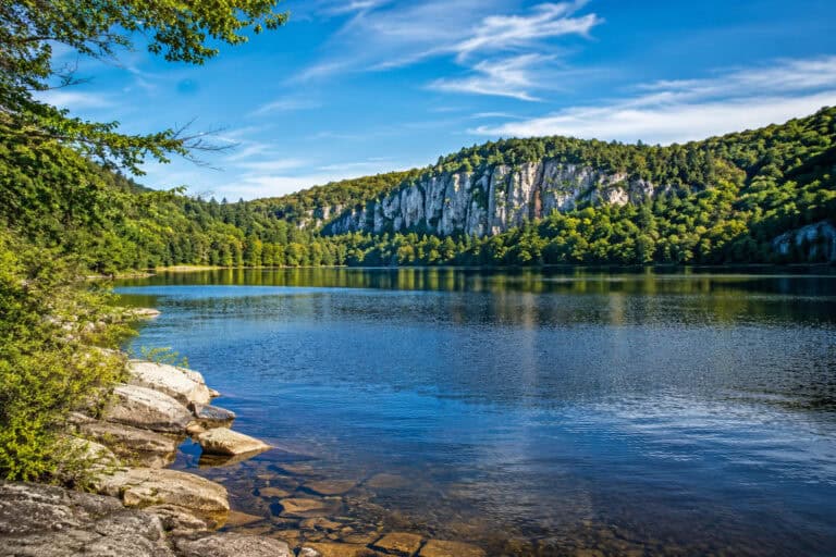
Apart from the scenic forest setting, the loop is famous for the overlook from which you can see a stunning, 200-foot cascade gushing down the exposed rocks on the hillside opposite. It’s a marvel!
As you might expect, the forest trail has lots of roots and rocks under feet, and the terrain is hilly but with just a few steep parts.
The only downside to this loop is that the waterfall isn’t always flowing. During the dry season, it is reduced to a mere trickle. So, if you want to see it in full glory, try visiting in spring or after a few rainy days.
4. Stiles Falls Trail

- Type: Out and Back
- Trail Length: 3.4 miles
- Elevation Gain: 326 ft
- Time to Complete: 2h
- Difficulty: Easy
- Parking: Alta Mons Camp: Google Maps
- Distance from Blacksburg: 20 miles (30 min)
- Dog Friendly: Yes
Stiles Falls Trail is an easy trail to a charming cascade that runs along Purgatory Creek, which you have to wade a few times.
For the first part, it’s a flat hike on a gravel road, but towards the end, it gets steep, and if you want to get the full view of the falls, a little scramble is required.
Another highlight is the diverse wildlife that inhabits the area. You are almost guaranteed to see deer, turtles, fish, and plenty of different birds.
When it comes to waterfalls, most people prefer the Cascades Trail (#2), but Stiles Falls is a better option if you want to avoid the crowd.
Related: 9 Fantastic Recreational Lakes near Richmond, VA
5. Bald Knob Overlook

- Type: Out and Back
- Trail Length: 1 mile
- Elevation Gain: 421 ft
- Time to Complete: 45min
- Difficulty: Moderate
- Parking: Trailhead Lot: Google Maps
- Distance from Blacksburg: 17 miles (25 min)
- Dog Friendly: Yes
Bald Knob Trail is a popular hike to the overlook with a sweeping panorama over the valley and surrounding hills. If you hike for the views, you will love this spot.
Although short, the trail is very steep; it is a constant climb to the top from the get-go. Plus, the surface is loose gravel which is very slippy on the way down. Good hiking boots and hiking poles are recommended for this one.
Another issue is that the trail isn’t well-marked, and there are multiple overlooks. GPS App is a good idea for this one. Otherwise, just keep going up; eventually, you will reach the top.
But don’t let these downsides stop you from experiencing this hike. It’s all part of the fun!
Related: 12 Best Lakes near Roanoke
6. Huckleberry Trail

- Type: Point to Point
- Trail Length: 15.3 miles
- Elevation Gain: 700 ft
- Time to Complete: 8h
- Difficulty: Easy
- Parking: Clay St: Google Maps
- Distance from Blacksburg: 0.5 miles (1 min)
- Dog Friendly: Yes
Huckleberry Trail is the former railway bed that was converted to a multi-use trail for everyone to enjoy. It is one of the hundreds of rail-trails in America; you can learn more about this nationwide initiative here.
This trail is a paved route with a slight grade. It is an excellent choice for runners, cyclists, and walkers of all abilities. Also, it is wheelchair-accessible and stroller-approved because of its smooth surface, making it a perfect choice for families.
Huckleberry Trail has many access points as it runs through urban environments connecting Blacksburg to Christiansburg. There are plenty of benches for taking rests, and you can make your outing as long or as short as you wish!
To find out about the history of the trail and see the detailed map, check TrailLink.
7. Poverty Creek Trail + Pandapas Pond Area

- Type: Out and Back
- Trail Length: 13.6 miles
- Elevation Gain: 743 ft
- Time to Complete: 6h
- Difficulty: Easy
- Parking: Trailhead Lot: Google Maps
- Distance from Blacksburg: 6 miles (10 min)
- Dog Friendly: Yes
Poverty Creek Trail is a relatively flat and easy trail running along the aptly named creek. It is part of a wider day-use area designed for hiking, running, and MTBs. There are over 20 miles of trails here, all of which are well-marked and maintained.
The location has typical for the area terrain: a forest setting, with rocky and muddy sections but no overlooks. There are lots of rhododendrons and wildlife, too.
The best thing about the area is its proximity to the town. Ten minutes drive – and you are hiking, exploring the forest that feels wild and remote. Still, it can get quite busy during the weekends or holidays, but there is plenty of space for everyone.
Related: 9 Fantastic Recreational Lakes near Richmond, VA
8. Appalachian Trail to McAfee Knob

- Type: Out and Back
- Trail Length: 8 miles
- Elevation Gain: 1,854 ft
- Time to Complete: 4h
- Difficulty: Moderate
- Parking: Trailhead Lot: Google Maps
- Distance from Blacksburg: 23 miles (35 min)
- Dog Friendly: Yes
McAfee Knob is a bucket list destination rumored to have the best views in Virginia. It is undoubtedly very popular and highly rated. Plus, it sits on the Appalachian Trail, making it one of the most visited nature spots in the state.
There are two ways to get to the top: Appalachian Trail – a gradual but relentless climb, and the fire road – an easier, smoother option. If, like many, you are doing the romantic sunrise hike, choose the fire road; it’s a safer option.
Despite the long climb and the crowds, McAfee Knob is definitely worth a visit. The vistas from the top are simply remarkable!
9. Andy Layne Trail to Tinker Cliffs

- Type: Out and Back
- Trail Length: 7.5 miles
- Elevation Gain: 1,965 ft
- Time to Complete: 4h
- Difficulty: Moderate
- Parking: Trailhead Lot: Google Maps
- Distance from Blacksburg: 30 miles (45 min)
- Dog Friendly: Yes
Andy Layne Trail leads to Tinker Cliffs, a popular overlook with killer views of the valley that will leave you speechless.
The landscape of this hike is varied. It runs on a private pasture where you can meet curious cows and ascends to the peak with a few really steep but well-maintained sections.
It is one of those trails that you probably heard about, and in this case, it totally stands up to the hype.
10. Virginia’s Triple Crown Loop

- Type: Loop
- Trail Length: 35 miles
- Elevation Gain: 9,000 ft
- Time to Complete: 2-5 days
- Difficulty: Hard
- Parking: Trailhead Lot: Google Maps
- Distance from Blacksburg: 20 miles (25 min)
- Dog Friendly: Yes
Virginia’s Triple Crown Loop is a terrific backpacking route that connects all three of Virginia’s most popular peaks – Dragon’s Tooth, McAfee Knob and Tinker Cliffs. It is a grueling but rewarding adventure that will test you physically and mentally.
Most hikers start the loop at McAfee Knob Trailhead and go counterclockwise, staying in shelters and campsites along the way. Alternatively, you can start by climbing to the Dragon’s Tooth, returning to the trailhead, and then completing the loop.
There are many other ways to approach this hike, but whichever you choose, it’s going to be strenuous. In addition to the distance, climbing 9,000ft in a couple of days is no joke. Plus, most of the hike is on the exposed ridges that get windy and cold. Needless to say, this is not for beginners.
To increase the chances of success, careful planning is required. The best resource is the Roanoke Appalachian Trail Club that maintains the route and has an active Facebook group with up-to-date information.
Final Thoughts
Blacksburg is a brilliant hiking gateway with tons of bucket list destinations. If you are considering visiting, don’t think twice, you will have fantastic trail adventures here.
And if you need some outdoor motivation, try Inspirational Hiking Quotes; they work as great Instagram captions, too.
Lakes in Virginia: